Butzbach - Butzbach Pfingstweide
Airport details
| Country | Germany |
| State | Hesse |
| Region | ED |
| Airspace | Langen Ctr |
| Municipality | Butzbach |
| Elevation | 1105ft (337m) |
| Timezone | GMT +1 |
| Coordinates | 50.43625, 8.61580 |
| Magnetic var | |
| Type | land |
| Available since | X-Plane v10.40 |
| ICAO code | ED06 |
| IATA code | n/a |
| FAA code | n/a |
Communication
| Butzbach Pfingstweide Butzbach Info | 129.500 |
Nearby Points of Interest:
Evangelische Pfarrkirche Ebersgöns
-Butzbach Prison
-Gießener Straße 24 (Pohl-Göns)
-Evangelische Pfarrkirche Kirch-Göns
-Evangelische Kirche (Fauerbach vor der Höhe)
-Evangelische Kirche
-Menhir von Ober-Mörlen
-Evangelische Kirche (Griedelbach)
-Schillerstraße 57 (Lang-Göns)
-Obergasse 20 (Lang-Göns)
-Moorgasse 17
-Jüdischer Friedhof (Kirchhain)
-Klosterkirche
-Jüdischer Friedhof
-Justizvollzugsanstalt Rockenberg
-Evangelische Pfarrkirche (Gambach)
-Evangelische Pfarrkirche Oberwetz
-Ringwall Holzburg
-Alte Kirche
-Evangelische Pfarrkirche Rechtenbach
-Hauptstraße 192
-Evangelische Kirche Holzheim
-Löw’sches Schloss Steinfurth
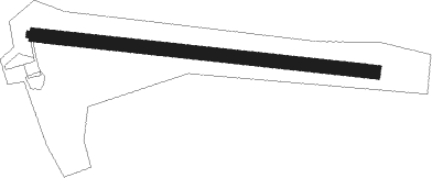
Runway info
Runway 11 / 29  | ||
| length | 502m (1647ft) | |
| bearing | 97° / 277° | |
| width | 14m (46ft) | |
| surface | asphalt | |
| displ threshold | 206m (676ft) / 0m (0ft) | |
| Runway 11C / 29C | ||
| length | 734m (2408ft) | |
| bearing | 97° / 277° | |
| width | 30m (98ft) | |
| surface | grass | |
Nearby beacons
| code | identifier | dist | bearing | frequency |
|---|---|---|---|---|
| MTR | METRO VOR | 13.1 | 124° | 110 |
| TAU | TAUNUS VOR/DME | 20.6 | 248° | 113.35 |
| FR | FRANKFURT NDB | 22.4 | 170° | 297 |
| FFM | FRANKFURT VORTAC | 22.9 | 177° | 114.20 |
| SIL | SIEGERLAND NDB | 23.3 | 297° | 489 |
| GED | GEDERN VORTAC | 24.2 | 92° | 110.80 |
| FRD | DME | 24.4 | 187° | 115.90 |
| SLD | DME | 26.1 | 297° | 108.05 |
| WIB | WIESBADEN TACAN | 26.1 | 218° | 114.10 |
| FW | FRANKFURT NDB | 26.8 | 203° | 382 |
| VFM | NAUHEIM VOR | 29 | 197° | 113.75 |
| CHA | CHARLIE VOR/DME | 34.9 | 141° | 115.35 |
| FUL | FULDA VOR/DME | 37.7 | 81° | 112.10 |
| RID | RIED VOR/DME | 39.4 | 186° | 112.20 |
| FTZ | FRITZLAR NDB | 49.3 | 51° | 468 |
| GMH | GERMINGHAUSEN VOR/DME | 51.9 | 315° | 115.40 |
| MND | DME | 58.1 | 186° | 113.55 |
| DKS | DME-ILS | 66.2 | 39° | 111.50 |
Disclaimer
The information on this website is not for real aviation. Use this data with the X-Plane flight simulator only! Data taken with kind consent from X-Plane 12 source code and data files. Content is subject to change without notice.