Taber
Airport details
| Country | Canada |
| State | Alberta |
| Region | |
| Airspace | Edmonton Ctr |
| Municipality | Municipal District of Taber |
| Elevation | 2646ft (807m) |
| Timezone | GMT -7 |
| Coordinates | 49.82413, -112.19044 |
| Magnetic var | |
| Type | land |
| Available since | X-Plane v10.40 |
| ICAO code | ED5 |
| IATA code | n/a |
| FAA code | n/a |
Communication
| Taber UNICOM / Traffic | 122.800 |
Nearby Points of Interest:
Stirling Agricultural Village
-Michelsen Farmstead
-William T. Ogden House
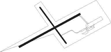
Runway info
Runway 05 / 23  | ||
| length | 914m (2999ft) | |
| bearing | 74° / 254° | |
| width | 23m (75ft) | |
| surface | asphalt | |
| Runway 13 / 31 | ||
| length | 592m (1942ft) | |
| bearing | 136° / 316° | |
| width | 14m (45ft) | |
| surface | asphalt | |
Nearby beacons
| code | identifier | dist | bearing | frequency |
|---|---|---|---|---|
| YQL | LETHBRIDGE VOR/DME | 21.7 | 248° | 115.70 |
| QL | LETHBRIDGE NDB | 30.3 | 253° | 248 |
| 6T | FOREMOST NDB | 34.1 | 116° | 362 |
| 9X | BROOKS NDB | 49.6 | 18° | 227 |
Disclaimer
The information on this website is not for real aviation. Use this data with the X-Plane flight simulator only! Data taken with kind consent from X-Plane 12 source code and data files. Content is subject to change without notice.