Dessau
Airport details
| Country | Germany |
| State | Saxony-Anhalt |
| Region | ED |
| Airspace | Munich Ctr |
| Municipality | Dessau-Roßlau |
| Elevation | 187ft (57m) |
| Timezone | GMT +1 |
| Coordinates | 51.83216, 12.18583 |
| Magnetic var | |
| Type | land |
| Available since | X-Plane v10.40 |
| ICAO code | EDAD |
| IATA code | n/a |
| FAA code | n/a |
Communication
| Dessau BERLIN INFO | 125.800 |
| Dessau INFO | 118.175 |
Nearby Points of Interest:
Dessau Aerodrome
-Villa Kämmerer
-Bootshaus im Leopoldshafen
-Schwabehaus
-Dessau
-Palais Branconi (Dessau)
-Palais Waldersee
-Dreieinigkeitskirche
-Jagdschloss Haideburg
-Dorfkirche Rodleben
-Dessau-Wörlitz Garden Realm
-Wegweiser Libbesdorf
-Church of Scheuder
-Aken railway station
-Kriegerstein (Schierau)
-Kriegerdenkmal Hinsdorf
-Kriegerdenkmal Marke (Anhalt)
-St. Nicolai (Steckby)
-Pißdorf Church
-Kleine Kirche
-Wörlitzer Park
-Kommunaler Friedhof Wörlitz
-Domäne Wörlitz
-Erdmannsdorffstraße 227
-Rathaus Köthen
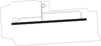
Runway info
| Runway 09 / 27 | ||
| length | 1001m (3284ft) | |
| bearing | 91° / 271° | |
| width | 25m (82ft) | |
| surface | asphalt | |
Nearby beacons
| code | identifier | dist | bearing | frequency |
|---|---|---|---|---|
| MAG | MAGDEBURG VOR/DME | 17.4 | 293° | 110.45 |
| LND | NORTH(LEIPZIG- DME | 23.9 | 174° | 113.50 |
| ZIG | LEIPZIG NDB | 24.1 | 167° | 340 |
| LLD | SOUTH(LEIPZIG- DME | 25.1 | 174° | 112.15 |
| SKZ | SCHKEUDITZ (LEIPZIG-HALLE) NDB | 25.2 | 168° | 357 |
| LEG | LEIPZIG VOR/DME | 26 | 144° | 115.85 |
| CB | COCHSTEDT NDB | 27.3 | 272° | 344 |
| HOZ | HOLZDORF NDB | 34 | 94° | 406 |
| GOT | GOTEM VOR/DME | 36.6 | 230° | 115.25 |
| ABU | ALTENBURG NDB | 51.8 | 158° | 330 |
| AGD | DME | 52.4 | 159° | 115.30 |
| ERF | ERFURT VOR/DME | 63.7 | 227° | 113.85 |
Disclaimer
The information on this website is not for real aviation. Use this data with the X-Plane flight simulator only! Data taken with kind consent from X-Plane 12 source code and data files. Content is subject to change without notice.