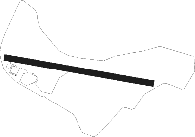
Marienberg - Grossrückerswalde
Airport details
| Country | Germany |
| State | Saxony |
| Region | ED |
| Airspace | Munich Ctr |
| Municipality | Großrückerswalde |
| Elevation | 2198ft (670m) |
| Timezone | GMT +1 |
| Coordinates | 50.64389, 13.12639 |
| Magnetic var | |
| Type | land |
| Available since | X-Plane v10.50 |
| ICAO code | EDAG |
| IATA code | n/a |
| FAA code | n/a |
Communication
| Grossrückerswalde Grossrückerswalde Info | 123.000 |
Nearby Points of Interest:
Marienberg
-Franziskanerkloster Annaberg
-St. Christophoruskirche Tannenberg
-Zschopenthal Blue Colour Works
-Sachgesamtheit Rittergut Olbernhau mit folgenden Einzeldenkmalen: Herrenhaus mit nachträglichen Anbauten (ursprünglich Stallungen, Remise und Scheune - Markt 5), Wirtschaftsgebäude und Gesindehaus über winkligem Grundriss (heute Museum - Markt 7)
-Dorfkirche Lippersdorf
-Church of Saint Wenceslaus
-Erlöserkirche
-Einsiedler Brauhaus
-St. Georg
-Church of Saint Martin
-Dorfkirche Schellenberg
-Johanniskirche
-Alte Kirche
-Dorfkirche Schwarzbach
-Bernhardsche Spinnerei
-Christuskirche
-Oberer Großhartmannsdorfer Teich
-Schule Chemnitz-Reichenhain
-Saint Anne church
-St. Johannis (Niederzwönitz)
-Church of Holy Trinity
-Sowjetischer Friedhof
-St. Barbarakirche
-Rittergut Großhartmannsdorf
Nearby beacons
| code | identifier | dist | bearing | frequency |
|---|---|---|---|---|
| L | VRATA (KARLOVY VARY) NDB | 27.8 | 202° | 365 |
| DRN | DRESDEN VOR/DME | 28.6 | 52° | 114.35 |
| AGD | DME | 30.9 | 299° | 115.30 |
| ABU | ALTENBURG NDB | 31.1 | 300° | 330 |
| DND | DME | 37.7 | 52° | 115.40 |
| FS | DRESDEN NDB | 42.8 | 53° | 374 |
| OKG | CHEB VOR/DME | 44.3 | 231° | 115.70 |
| LEG | LEIPZIG VOR/DME | 53.5 | 321° | 115.85 |
| SKZ | SCHKEUDITZ (LEIPZIG-HALLE) NDB | 56.4 | 312° | 357 |
| ZIG | LEIPZIG NDB | 57.2 | 313° | 340 |
| LLD | SOUTH(LEIPZIG- DME | 57.3 | 311° | 112.15 |
| LND | NORTH(LEIPZIG- DME | 58.3 | 311° | 113.50 |
| PSK | DME | 62.2 | 133° | 117.60 |
Disclaimer
The information on this website is not for real aviation. Use this data with the X-Plane flight simulator only! Data taken with kind consent from X-Plane 12 source code and data files. Content is subject to change without notice.