Neustadt - Segeletz
Airport details
| Country | Germany |
| State | Brandenburg |
| Region | ED |
| Airspace | Bremen Ctr |
| Municipality | Wusterhausen/Dosse |
| Elevation | 142ft (43m) |
| Timezone | GMT +1 |
| Coordinates | 52.82639, 12.54194 |
| Magnetic var | |
| Type | land |
| Available since | X-Plane v10.40 |
| ICAO code | EDAI |
| IATA code | n/a |
| FAA code | n/a |
Communication
Nearby Points of Interest:
Burgwall Wildberg (Temnitztal)
-St. Peter and Paul Wusterhausen
-Village church Kerzlin
-Dorfkirche Sieversdorf (Sieversdorf-Hohenofen)
-Dorfkirche Kleßen
-Village church Kantow
-Dorfkirche Gottberg
-Village church Brunne
-Zernitz station
-Village church Dabergotz
-Village church Holzhausen (Kyritz)
-Village church Langen (Fehrbellin)
-Dorfkirche Wagenitz
-Gut Buskow
-Dorfkirche Stüdenitz
-Village church Kriele
-Ruppiner Kliniken
-Village church Dechtow
-Dorfkirche Spaatz
-Village church Paulinenaue
-Dorfkirche Kotzen
-Wustrau church
-Village church Karwe
-Village church Lichtenberg (Neuruppin)
-Village church Demerthin
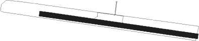
Runway info
| Runway 10 / 28 | ||
| length | 927m (3041ft) | |
| bearing | 98° / 278° | |
| width | 28m (92ft) | |
| surface | grass | |
| displ threshold | 18m (59ft) / 15m (49ft) | |
Nearby beacons
| code | identifier | dist | bearing | frequency |
|---|---|---|---|---|
| LWB | LOEWENBERG VOR/DME | 22 | 82° | 114.55 |
| BKD | BRUENKENDORF VOR/DME | 38.1 | 282° | 117.70 |
| BBI | BERLIN BRANDENBURG VOR/DME | 44.2 | 118° | 114.10 |
| SDD | DME | 44.3 | 115° | 114.40 |
| PI | SCHWERIN-PARCHIM NDB | 44.4 | 315° | 333 |
| PMD | DME | 45.1 | 308° | 117.50 |
| PAH | SCHWERIN-PARCHIM NDB | 46.4 | 303° | 315 |
| MAG | MAGDEBURG VOR/DME | 56.9 | 222° | 110.45 |
Disclaimer
The information on this website is not for real aviation. Use this data with the X-Plane flight simulator only! Data taken with kind consent from X-Plane 12 source code and data files. Content is subject to change without notice.