Neustadt-glewe
Airport details
| Country | Germany |
| State | Mecklenburg-Vorpommern |
| Region | ED |
| Airspace | Bremen Ctr |
| Municipality | Neustadt-Glewe |
| Elevation | 113ft (34m) |
| Timezone | GMT +1 |
| Coordinates | 53.36100, 11.61517 |
| Magnetic var | |
| Type | land |
| Available since | X-Plane v10.40 |
| ICAO code | EDAN |
| IATA code | n/a |
| FAA code | n/a |
Communication
| Neustadt-Glewe Neustadt Info | 123.375 |
Nearby Points of Interest:
Town hall in Neustadt-Glewe
-Hechtsforthschleuse
-Funkamt Wöbbelin
-Wöbbelin concentration camp
-Helenen-Paulownen-Mausoleum
-Rathaus Grabow
-Ludwigsluster Kanal
-Burgwall Wulfsahl
-Klein Warnow station
-Church in Klinken
-Moltkedenkmal
-Town hall in Parchim
-Bartholomäuskapelle Parchim
-Church in Dargelütz
-Church in Marnitz
-Burgwall Crivitz
-Synagoge Crivitz
-Church in Herzberg
-Village church Porep
-Kurhotel Schwerin-Zippendorf
-Church in Gammelin
-Jüdischer Friedhof (Lübz)
-Giant sequoias near Kölpin
-Philippshof
-Schloss Basthorst
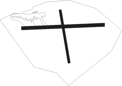
Runway info
Runway 17 / 35  | ||
| length | 775m (2543ft) | |
| bearing | 171° / 351° | |
| width | 35m (115ft) | |
| surface | grass | |
| displ threshold | 143m (469ft) / 135m (443ft) | |
| Runway 09 / 27 | ||
| length | 1200m (3937ft) | |
| bearing | 91° / 271° | |
| width | 50m (164ft) | |
| surface | grass | |
| displ threshold | 218m (715ft) / 265m (869ft) | |
Nearby beacons
| code | identifier | dist | bearing | frequency |
|---|---|---|---|---|
| PAH | SCHWERIN-PARCHIM NDB | 2.6 | 57° | 315 |
| PMD | DME | 7.1 | 69° | 117.50 |
| PI | SCHWERIN-PARCHIM NDB | 12 | 71° | 333 |
| BKD | BRUENKENDORF VOR/DME | 19.7 | 192° | 117.70 |
| LAG | LAAGE TACAN | 41.2 | 50° | 108.25 |
| LYE | LUEBECK NDB | 42 | 296° | 394 |
| HLZ | HEHLINGEN VOR/DME | 66.8 | 219° | 117.30 |
Disclaimer
The information on this website is not for real aviation. Use this data with the X-Plane flight simulator only! Data taken with kind consent from X-Plane 12 source code and data files. Content is subject to change without notice.