Nordhausen
Airport details
| Country | Germany |
| State | Thuringia |
| Region | ED |
| Airspace | Munich Ctr |
| Municipality | Nordhausen |
| Elevation | 687ft (209m) |
| Timezone | GMT +1 |
| Coordinates | 51.49306, 10.83333 |
| Magnetic var | |
| Type | land |
| Available since | X-Plane v10.40 |
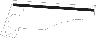
| ICAO code | EDAO |
| IATA code | n/a |
| FAA code | n/a |
Communication
| Nordhausen Nordhausen Info | 118.625 |
Nearby Points of Interest:
St. Laurentius
-Schloss Kleinwerther
-St. Nicolai
-St. Andreas
-Menhir von Berga
-Chalet Waldfrieden
-Rathaus Stolberg (Harz)
-Church in Pustleben
-St. Margaretha
-St. Wigberti
-Kirche St.Martini
-Kirche Elende
-Brauerei Kelbra
-Church in Großberndten
-Stabkirche Stiege
-Jagdschloss Walkenried
-Ellerteich
-St.-Marien-und-Anna-Kirche
-Bergsee
-St. Mariä Geburt
-Bahnhof Güntersberge
-Halle-Kasseler-Straße 188
-Distanzstein Güntersberge
-Meilenstein Güntersberge
Nearby beacons
| code | identifier | dist | bearing | frequency |
|---|---|---|---|---|
| GOT | GOTEM VOR/DME | 30 | 101° | 115.25 |
| EFD | DME | 31 | 166° | 112.05 |
| CB | COCHSTEDT NDB | 31.8 | 59° | 344 |
| ERF | ERFURT VOR/DME | 35.9 | 143° | 113.85 |
| MAG | MAGDEBURG VOR/DME | 46.7 | 62° | 110.45 |
| BRU | BRAUNSCHWEIG-WOLFSBURG NDB | 50.5 | 345° | 427 |
| HLZ | HEHLINGEN VOR/DME | 52.2 | 357° | 117.30 |
| DLE | LEINE VOR/DME | 57.5 | 309° | 115.20 |
| SAS | SARSTEDT VOR/DME | 57.5 | 309° | 114.45 |
Disclaimer
The information on this website is not for real aviation. Use this data with the X-Plane flight simulator only! Data taken with kind consent from X-Plane 12 source code and data files. Content is subject to change without notice.