Cottbus - Neuhausen
Airport details
| Country | Germany |
| State | Brandenburg |
| Region | ED |
| Airspace | Bremen Ctr |
| Municipality | Neuhausen/Spree |
| Elevation | 277ft (84m) |
| Timezone | GMT +1 |
| Coordinates | 51.68483, 14.42317 |
| Magnetic var | |
| Type | land |
| Available since | X-Plane v10.40 |
| ICAO code | EDAP |
| IATA code | n/a |
| FAA code | n/a |
Communication
| Neuhausen Neuhausen Info | 122.725 |
Nearby Points of Interest:
Dorfkirche Komptendorf
-Dorfkirche Klein Döbbern
-Dorfkirche Groß Döbbern
-Dorfkirche Groß Gaglow
-Carl-Thiem-Klinikum Cottbus
-Christuskirche
-Auguste-Stiftung (Cottbus)
-Dorfkirche Groß Luja
-Bürger-Kasino
-Rudolf-Breitscheid-Straße
-Breitscheidplatz 2
-Wilhelmsmühle
-Bahnhofstraße 24
-Amtsgericht Cottbus
-Bahnhofstraße
-Schlosskirche Cottbus
-Gertraudtenstraße 1 (Cottbus)
-Spremberger Straße
-Stadtpromenade 10-12
-Karl-Liebknecht-Straße (Cottbus)
-Paul-Werner-Oberschule
-Neues Rathaus
-Augusta-Schule
-Puschkinpromenade (Cottbus)
-Stadthaus
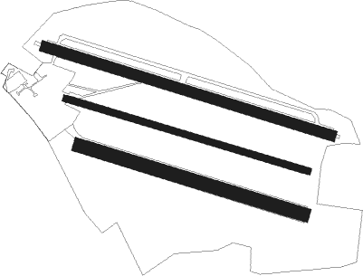
Runway info
Runway 11 / 29  | ||
| length | 1113m (3652ft) | |
| bearing | 104° / 284° | |
| width | 40m (131ft) | |
| surface | grass | |
| Runway 11C / 29C | ||
| length | 941m (3087ft) | |
| bearing | 104° / 284° | |
| width | 25m (82ft) | |
| surface | grass | |
| Runway 11R / 29L | ||
| length | 870m (2854ft) | |
| bearing | 104° / 284° | |
| width | 50m (164ft) | |
| surface | grass | |
Nearby beacons
| code | identifier | dist | bearing | frequency |
|---|---|---|---|---|
| FS | DRESDEN NDB | 36.5 | 229° | 374 |
| KLF | KLASDORF VOR/DME | 37.6 | 291° | 115.15 |
| DND | DME | 41.6 | 230° | 115.40 |
| FWE | FUERSTENWALDE VOR/DME | 44.9 | 338° | 113.30 |
| HDO | HERMSDORF VOR/DME | 45.4 | 184° | 108.65 |
| DRN | DRESDEN VOR/DME | 50.7 | 231° | 114.35 |
| OKX | FRYDLANT VOR/DME | 52.2 | 142° | 114.85 |
| BBI | BERLIN BRANDENBURG VOR/DME | 53.3 | 304° | 114.10 |
| SDD | DME | 53.5 | 307° | 114.40 |
Disclaimer
The information on this website is not for real aviation. Use this data with the X-Plane flight simulator only! Data taken with kind consent from X-Plane 12 source code and data files. Content is subject to change without notice.