Finsterwalde
Airport details
| Country | Germany |
| State | Brandenburg |
| Region | ED |
| Airspace | Bremen Ctr |
| Municipality | Finsterwalde |
| Elevation | 382ft (116m) |
| Timezone | GMT +1 |
| Coordinates | 51.63433, 13.67183 |
| Magnetic var | |
| Type | land |
| Available since | X-Plane v10.40 |
| ICAO code | EDAS |
| IATA code | n/a |
| FAA code | n/a |
Communication
Nearby Points of Interest:
Stadtpfarrkirche St. Trinitatis
-Münchhausen church
-Dorfkirche Massen (Niederlausitz)
-St. Pantaleon
-Dorfkirche Betten
-Schwert
-Rathaus (Doberlug-Kirchhain)
-Stadtpfarrkirche
-Rautenstock
-Protestant Church Lieskau
-Dorfkirche Lindena
-Dorfkirche Oppelhain
-Paltrockwindmühle Oppelhain
-Dorfkirche Großkrausnik
-Dorfkirche Rückersdorf
-Dorfkirche Schönborn
-Dorfkirche Gruhno
-Dorfkirche Göllnitz
-Dorfkirche Sallgast
-Dorfkirche Bornsdorf
-Dorfkirche Groß Mehßow
-Protestant Church (Stechau)
-Dorfkirche Wormlage
-Friedensgedächtniskirche
-Christus-König-Kirche (Lauchhammer)
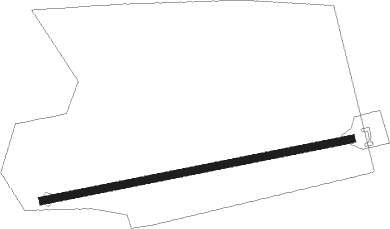
Runway info
| Runway 09 / 27 | ||
| length | 1041m (3415ft) | |
| bearing | 86° / 266° | |
| width | 25m (82ft) | |
| surface | grass | |
Nearby beacons
| code | identifier | dist | bearing | frequency |
|---|---|---|---|---|
| HOZ | HOLZDORF TACAN | 19.3 | 286° | 117.25 |
| HOZ | HOLZDORF NDB | 22.8 | 283° | 406 |
| KLF | KLASDORF VOR/DME | 23.4 | 344° | 115.15 |
| FS | DRESDEN NDB | 27.3 | 158° | 374 |
| DND | DME | 30.4 | 170° | 115.40 |
| DRN | DRESDEN VOR/DME | 37.2 | 187° | 114.35 |
| BBI | BERLIN BRANDENBURG VOR/DME | 43.2 | 343° | 114.10 |
| SDD | DME | 44.8 | 347° | 114.40 |
| FWE | FUERSTENWALDE VOR/DME | 49.6 | 31° | 113.30 |
| HDO | HERMSDORF VOR/DME | 49.8 | 135° | 108.65 |
Disclaimer
The information on this website is not for real aviation. Use this data with the X-Plane flight simulator only! Data taken with kind consent from X-Plane 12 source code and data files. Content is subject to change without notice.