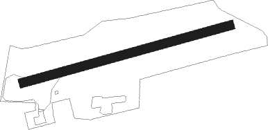
Hoyerswerda - Nardt
Airport details
| Country | Germany |
| State | Saxony |
| Region | ED |
| Airspace | Munich Ctr |
| Municipality | Hoyerswerda - Wojerecy |
| Elevation | 382ft (116m) |
| Timezone | GMT +1 |
| Coordinates | 51.45167, 14.20250 |
| Magnetic var | |
| Type | land |
| Available since | X-Plane v10.40 |
| ICAO code | EDAT |
| IATA code | n/a |
| FAA code | n/a |
Communication
| Nardt Nardt Info | 123.000 |
Nearby Points of Interest:
Altes Rathaus
-Neues Rathaus
-Kirche Laubusch
-Dorfkirche Torno
-Village church Großkoschen
-Village church Proschim
-Village church Hosena
-Dorfkirche Lieske
-Village church Welzow
-Dorfkirche Hohenbocka
-Dorfkirche Sedlitz
-Schloss Senftenberg
-Mahnmal für die Opfer des Faschismus und Militarismus in Senftenberg
-Bergbauhaus
-Amtsgericht Senftenberg
-Wendische Kirche
-Lutherkirche
-Dorfkirche Allmosen
-Windmill in Dörrwalde
-Dorfkirche Dörrwalde
-Gutshaus Schwarzbach
-Fledermausschloss Weißig
-Dorfkirche Neupetershain-Nord
-Dorfkirche Steinitz
-Schloss Guteborn
Nearby beacons
| code | identifier | dist | bearing | frequency |
|---|---|---|---|---|
| FS | DRESDEN NDB | 20.4 | 234° | 374 |
| DND | DME | 25.5 | 234° | 115.40 |
| HDO | HERMSDORF VOR/DME | 32 | 162° | 108.65 |
| DRN | DRESDEN VOR/DME | 34.6 | 234° | 114.35 |
| KLF | KLASDORF VOR/DME | 41.5 | 312° | 115.15 |
| OKX | FRYDLANT VOR/DME | 45.4 | 124° | 114.85 |
| FWE | FUERSTENWALDE VOR/DME | 57.6 | 356° | 113.30 |
| BBI | BERLIN BRANDENBURG VOR/DME | 60.2 | 320° | 114.10 |
| SDD | DME | 61.1 | 323° | 114.40 |
Disclaimer
The information on this website is not for real aviation. Use this data with the X-Plane flight simulator only! Data taken with kind consent from X-Plane 12 source code and data files. Content is subject to change without notice.