Lärz - Rechlin-lärz
Airport details
| Country | Germany |
| State | Mecklenburg-Vorpommern |
| Region | ED |
| Airspace | Bremen Ctr |
| Municipality | Lärz |
| Elevation | 219ft (67m) |
| Timezone | GMT +1 |
| Coordinates | 53.30510, 12.75208 |
| Magnetic var | |
| Type | land |
| Available since | X-Plane v10.40 |
| ICAO code | EDAX |
| IATA code | REB |
| FAA code | n/a |
Communication
| Rechlin-Lärz Laerz Info | 129.975 |
Nearby Points of Interest:
Gutshaus Buschhof
-Church in Leussow
-Gutshaus Ludorf
-Burgwall von Kieve
-Synagoge
-Town hall in Röbel/Müritz
-Church in Blankenförde
-Scheune Bollewick
-Röbel (Meckl) railway station
-Village church Dranse
-Village church Schweinrich
-Church in Minzow
-manoir de Federow
-Riesenstein
-Village church Klein Haßlow
-Hebetempel (Neustrelitz)
-Schloss Neustrelitz
-Orangerie
-Artillerie- und Infanteriekaserne Neustrelitz
-Jewish Cemetery
-Technikum Strelitz
-Village church Wulfersdorf, Wittstock
-Waren Town Hall
-Schloss Blücher
-Church in Zahren
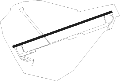
Runway info
| Runway 07 / 25 | ||
| length | 2372m (7782ft) | |
| bearing | 81° / 261° | |
| width | 50m (164ft) | |
| surface | concrete | |
| displ threshold | 156m (512ft) / 1019m (3343ft) | |
Nearby beacons
| code | identifier | dist | bearing | frequency |
|---|---|---|---|---|
| LWB | LOEWENBERG VOR/DME | 27.4 | 136° | 114.55 |
| PI | SCHWERIN-PARCHIM NDB | 31.6 | 280° | 333 |
| PMD | DME | 35.3 | 277° | 117.50 |
| FLD | FRIEDLAND VOR/DME | 39.9 | 61° | 117.15 |
| LAG | LAAGE TACAN | 40.4 | 323° | 108.25 |
| SDD | DME | 62.1 | 141° | 114.40 |
| BBI | BERLIN BRANDENBURG VOR/DME | 63.2 | 144° | 114.10 |
Disclaimer
The information on this website is not for real aviation. Use this data with the X-Plane flight simulator only! Data taken with kind consent from X-Plane 12 source code and data files. Content is subject to change without notice.