Trebbin - Schonhagen
Airport details
| Country | Germany |
| State | Brandenburg |
| Region | ED |
| Airspace | Bremen Ctr |
| Municipality | Trebbin |
| Elevation | 129ft (39m) |
| Timezone | GMT +1 |
| Coordinates | 52.20800, 13.15650 |
| Magnetic var | |
| Type | land |
| Available since | X-Plane v10.40 |
| ICAO code | EDAZ |
| IATA code | QXH |
| FAA code | n/a |
Communication
| Schonhagen INFO | 122.700 |
| Schonhagen Departure | 133.000 |
Nearby Points of Interest:
Landwerk Ahrensdorf
-Burg Trebbin
-Rathaus Trebbin
-Neues Schützenhaus
-Dorfkirche Dobbrikow
-Village church Rieben
-Pfarrhaus Christinendorf
-Schmiede Luckenwalder Straße 222
-Dorfkirche Fresdorf
-Gutshaus Märkisch Wilmersdorf
-Wildenbruch church
-Village church Schönefeld (Beelitz)
-Dorfkirche Woltersdorf
-Waldfriedhof Luckenwalde
-Wittbrietzen church
-Stalag III-A
-Dorfkirche Elsholz
-Landesinstitut für Schule und Medien Berlin-Brandenburg
-Dorfkirche Schöneweide
-Dorfkirche Langerwisch
-E-Werk Luckenwalde
-Dorfkirche Kemnitz (Nuthe-Urstromtal)
-Herrenhaus Löwenbruch
-Village church Schenkenhorst (Stahnsdorf)
-Dorfkirche
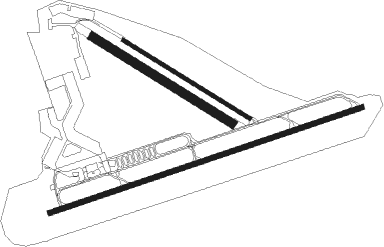
Runway info
Runway 07 / 25  | ||
| length | 1548m (5079ft) | |
| bearing | 81° / 261° | |
| width | 23m (75ft) | |
| surface | asphalt | |
| displ threshold | 171m (561ft) / 281m (922ft) | |
| Runway 12 / 30 | ||
| length | 699m (2293ft) | |
| bearing | 114° / 294° | |
| width | 18m (59ft) | |
| surface | asphalt | |
| Runway 12R / 30L | ||
| length | 769m (2523ft) | |
| bearing | 114° / 294° | |
| width | 40m (131ft) | |
| surface | grass | |
Nearby beacons
| code | identifier | dist | bearing | frequency |
|---|---|---|---|---|
| BBI | BERLIN BRANDENBURG VOR/DME | 13.5 | 66° | 114.10 |
| SDD | DME | 16.2 | 64° | 114.40 |
| KLF | KLASDORF VOR/DME | 18.8 | 115° | 115.15 |
| HOZ | HOLZDORF NDB | 26.3 | 188° | 406 |
| HOZ | HOLZDORF TACAN | 26.5 | 175° | 117.25 |
| FWE | FUERSTENWALDE VOR/DME | 37.7 | 78° | 113.30 |
| LWB | LOEWENBERG VOR/DME | 42.1 | 358° | 114.55 |
| LEG | LEIPZIG VOR/DME | 52.8 | 221° | 115.85 |
| ZIG | LEIPZIG NDB | 56.7 | 229° | 340 |
| SKZ | SCHKEUDITZ (LEIPZIG-HALLE) NDB | 57.8 | 228° | 357 |
| LND | NORTH(LEIPZIG- DME | 57.9 | 230° | 113.50 |
| LLD | SOUTH(LEIPZIG- DME | 58.7 | 229° | 112.15 |
Departure and arrival routes
| SID end points | distance | outbound heading | |
|---|---|---|---|
| RW07 | |||
| BOLB1N | 25mi | 181° | |
| RW25 | |||
| BOLB1A | 25mi | 181° | |
Instrument approach procedures
| runway | airway (heading) | route (dist, bearing) |
|---|---|---|
| RW25 | MOSEX (33°) | MOSEX 3000ft AZ255 (11mi, 60°) 3000ft AZ254 (7mi, 43°) 2000ft AZ253 (5mi, 73°) 2000ft AZ250 (4mi, 337°) 1700ft |
| RNAV | AZ250 1700ft TRIBY (4mi, 261°) 1700ft EDAZ (4mi, 263°) 192ft AZ259 (2mi, 256°) AZ260 (7mi, 191°) 2000ft MOSEX (10mi, 215°) 3000ft |
Disclaimer
The information on this website is not for real aviation. Use this data with the X-Plane flight simulator only! Data taken with kind consent from X-Plane 12 source code and data files. Content is subject to change without notice.