Wülfershausen - Arnstadt-alkersleben
Airport details
| Country | Germany |
| State | Thuringia |
| Region | ED |
| Airspace | Munich Ctr |
| Municipality | Alkersleben |
| Elevation | 1145ft (349m) |
| Timezone | GMT +1 |
| Coordinates | 50.84184, 11.07000 |
| Magnetic var | |
| Type | land |
| Available since | X-Plane v10.45 |
| ICAO code | EDBA |
| IATA code | n/a |
| FAA code | n/a |
Communication
| Arnstadt-Alkersleben Arnstadt Info | 123.000 |
Nearby Points of Interest:
St. Vitus
-Dorfkirche Elleben
-Dorfkirche Wüllersleben
-St.-Magdalenen-Kirche Witzleben
-Protestant Church (Achelstädt)
-Schloss Marienburg
-Walpurgiskloster
-St. Burkhard (Nauendorf)
-Protestant Church
-Kirche Breitenheerda
-Saint Wigbert Church (Sülzenbrücken)
-Sophienheilstätte
-Hochhaus des Thüringer Landtags
-Kirche Remda
-Kirche Kirchremda
-Dorfkirche Sundremda
-Zentralklinik Bad Berka
-Kurmainzische Statthalterei Erfurt
-Haus Vaterland
-Schloss Rodberg
-Hauptpostamt Erfurt
-Protestant Church Heyda
-Erfurt Treasure
-Haus zum Turnier
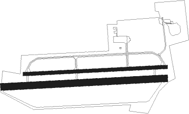
Runway info
Runway 09 / 27  | ||
| length | 929m (3048ft) | |
| bearing | 91° / 271° | |
| width | 23m (75ft) | |
| surface | asphalt | |
| displ threshold | 30m (98ft) / 30m (98ft) | |
| Runway 09R / 27L | ||
| length | 1069m (3507ft) | |
| bearing | 91° / 271° | |
| width | 45m (148ft) | |
| surface | grass | |
Nearby beacons
| code | identifier | dist | bearing | frequency |
|---|---|---|---|---|
| ERF | ERFURT VOR/DME | 9 | 57° | 113.85 |
| EFD | DME | 9.4 | 321° | 112.05 |
| GOT | GOTEM VOR/DME | 36 | 46° | 115.25 |
| BAY | BAYREUTH VOR | 55.8 | 147° | 110.60 |
Disclaimer
The information on this website is not for real aviation. Use this data with the X-Plane flight simulator only! Data taken with kind consent from X-Plane 12 source code and data files. Content is subject to change without notice.