Airports for X-Plane offers a convenient way to explore airports and their related communication information for the X-Plane flight simulator. It only uses data from the X-Plane flight simulator itself, and is therefore more reliable than the data that comes from real aviation websites. You can search for airports by using the ICAO code, or browse for airports per country and state. The information displayed is categorized by airport details, runway information, airport communication, approach frequencies (ILS and Glidepath details), details of nearby beacons, SIDs, STARs and approach procedures.

station port hospital heliport frankfurt airport luggage road nation train station airspeed aviation hangar airfield traffic pattern hotel helipad control tower warfare airliner landing area aircraft

Brandenburg An Der Havel - Brandenburg/mühlenfeld

Airport details

CountryGermany
StateBrandenburg
RegionED
AirspaceBremen Ctr
MunicipalityBrandenburg an der Havel
Elevation100ft (30m)
TimezoneGMT +1
Coordinates52.43639, 12.59056
Magnetic var
Typeland
Available sinceX-Plane v10.45
ICAO codeEDBE
IATA coden/a
FAA coden/a

Communication

Brandenburg/Mühlenfeld Brandenburg Info118.625
Nearby Points of Interest:
Brandenburg Krakauer Tor railway station
-
Beetzsee Regatta Course
-
St.-Petri-Hospital
-
Saldria
-
Wohn- und Geschäftshaus Gustav Weyland
-
Quitzowhaus
-
Ordonnanzhaus
-
Jüdisches Gemeindehaus (Brandenburg an der Havel)
-
Altstädtisches Rathaus (Brandenburg an der Havel)
-
Sekretariats- und Syndikatshaus
-
Gedenkstätte für die ermordeten Antifaschisten
-
Gotisches Haus (Brandenburg an der Havel)
-
Neustädtische Gelehrtenschule
-
Carpzowsches Haus
-
Städtisches Klinikum Brandenburg
-
Wohnhaus Dorfstraße 8
-
Dorfkirche Weseram
-
Wohnhaus Dorfstraße 30
-
Pfarrgehöft Dorfstraße 31
-
Gehöft Unter den Linden 11
-
Gehöft Dorfstraße 29
-
Protestant Church (Lünow)
-
Möweninsel Buhnenwerder
-
Brandenburg-Görden Prison
-
Pfarrhaus Hohenferchesar

Runway info

Runway 10 / 28
 length731m (2398ft)
 bearing97° / 277°
 width40m (131ft)
 surfacegrass

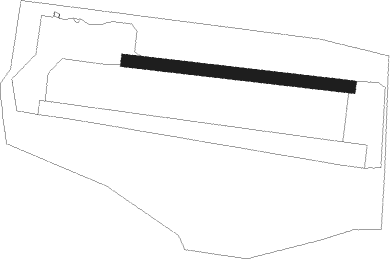
Airport layout


Nearby beacons

codeidentifierdistbearingfrequency
BBIBERLIN BRANDENBURG VOR/DME32.196°114.10
SDDDME33.694°114.40
LWBLOEWENBERG VOR/DME34.649°114.55
MAGMAGDEBURG VOR/DME39.5241°110.45
KLFKLASDORF VOR/DME43.6113°115.15
HOZHOLZDORF NDB44.1143°406
HOZHOLZDORF TACAN46138°117.25
PMDDME66.1321°117.50
PAHSCHWERIN-PARCHIM NDB66.5316°315

Disclaimer

The information on this website is not for real aviation. Use this data with the X-Plane flight simulator only! Data taken with kind consent from X-Plane 12 source code and data files. Content is subject to change without notice.