Laucha An Der Unstrut - Laucha
Airport details
| Country | Germany |
| State | Saxony-Anhalt |
| Region | ED |
| Airspace | Munich Ctr |
| Municipality | Laucha an der Unstrut |
| Elevation | 737ft (225m) |
| Timezone | GMT +1 |
| Coordinates | 51.24611, 11.69306 |
| Magnetic var | |
| Type | land |
| Available since | X-Plane v10.40 |
| ICAO code | EDBL |
| IATA code | n/a |
| FAA code | n/a |
Communication
| Laucha Laucha Info | 122.475 |
Nearby Points of Interest:
Schleuse Laucha
-Glockenmuseum Laucha
-Rathaus Laucha an der Unstrut
-Herrenhaus Weischütz
-Schleuse Zeddenbach
-Town hall in Freyburg
-Bahnhof Freyburg
-Protestant Church Steinbach
-Rathaus Mücheln
-Sankt-Jakobi-Kirche
-Kirche Burgheßler
-Dorfkirche Spielberg
-Geiseltalsee-Kirche
-Kriegerdenkmal Barnstädt
-Bockwindmühle Langeneichstädt
-Pforta abbey
-Totenleuchte
-Mutiger Ritter
-Romanisches Haus (Bad Kösen)
-Dorfkirche Gößnitz (An der Poststraße)
-Oberlandesgericht Naumburg
-Ägidienkurie (Naumburg)
-Berghotel Wilhelmsburg
-Naumburg Cathedral and the High Medieval Cultural Landscape of the Rivers Saale and Unstrut
-Domplatz 21
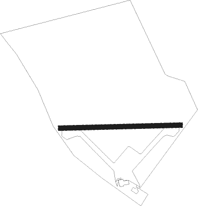
Runway info
| Runway 09 / 27 | ||
| length | 731m (2398ft) | |
| bearing | 92° / 272° | |
| width | 30m (98ft) | |
| surface | grass | |
Nearby beacons
| code | identifier | dist | bearing | frequency |
|---|---|---|---|---|
| GOT | GOTEM VOR/DME | 6.8 | 315° | 115.25 |
| LLD | SOUTH(LEIPZIG- DME | 22.5 | 73° | 112.15 |
| LND | NORTH(LEIPZIG- DME | 22.9 | 71° | 113.50 |
| SKZ | SCHKEUDITZ (LEIPZIG-HALLE) NDB | 23.9 | 74° | 357 |
| ERF | ERFURT VOR/DME | 24.7 | 237° | 113.85 |
| ZIG | LEIPZIG NDB | 24.7 | 72° | 340 |
| LEG | LEIPZIG VOR/DME | 31.4 | 76° | 115.85 |
| EFD | DME | 31.9 | 250° | 112.05 |
| ABU | ALTENBURG NDB | 34.6 | 107° | 330 |
| AGD | DME | 34.7 | 108° | 115.30 |
| CB | COCHSTEDT NDB | 37.9 | 338° | 344 |
| MAG | MAGDEBURG VOR/DME | 45.1 | 8° | 110.45 |
Disclaimer
The information on this website is not for real aviation. Use this data with the X-Plane flight simulator only! Data taken with kind consent from X-Plane 12 source code and data files. Content is subject to change without notice.