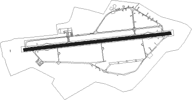
Neubrandenburg - Neubrandenburg-trollenhagen
Airport details
| Country | Germany |
| State | Mecklenburg-Vorpommern |
| Region | ED |
| Airspace | Bremen Ctr |
| Municipality | Trollenhagen |
| Elevation | 226ft (69m) |
| Timezone | GMT +1 |
| Coordinates | 53.60346, 13.29999 |
| Magnetic var | |
| Type | land |
| Available since | X-Plane v10.40 |
| ICAO code | EDBN |
| IATA code | FNB |
| FAA code | n/a |
Communication
| Neubrandenburg-Trollenhagen Neubrandenburg Tower | 119.175 |
Runway info
| Runway 09 / 27 | ||
| length | 2284m (7493ft) | |
| bearing | 89° / 269° | |
| width | 45m (148ft) | |
| surface | asphalt | |
Nearby beacons
| code | identifier | dist | bearing | frequency |
|---|---|---|---|---|
| FLD | FRIEDLAND VOR/DME | 13.3 | 59° | 117.15 |
| HC | HERINGSDORF NDB | 35.2 | 73° | 330 |
| LWB | LOEWENBERG VOR/DME | 42 | 193° | 114.55 |
Departure and arrival routes
| Transition altitude | 5000ft |
| SID end points | distance | outbound heading | |
|---|---|---|---|
| RW09 | |||
| GEVN1U | 12mi | 49° | |
| TIRM1U | 12mi | 104° | |
| BIGT1U | 15mi | 260° | |
| LEGS1U | 20mi | 286° | |
| RW27 | |||
| GEVN1X | 12mi | 49° | |
| TIRM1X | 12mi | 104° | |
| BIGT1X | 15mi | 260° | |
| LEGS1X | 20mi | 286° | |
Instrument approach procedures
| runway | airway (heading) | route (dist, bearing) |
|---|---|---|
| RW09 | BIGTI (80°) | BIGTI 4000ft BN500 (5mi, 52°) 3000ft |
| RW09 | GEVNI (229°) | GEVNI 3500ft BN506 (19mi, 261°) 3000ft BN500 (5mi, 176°) 3000ft |
| RW09 | LEGSA (106°) | LEGSA 4000ft BN505 (8mi, 137°) 3000ft BN500 (4mi, 118°) 3000ft |
| RW09 | TIRMI (284°) | TIRMI 4000ft BN502 (10mi, 269°) 4000ft BN501 (12mi, 268°) 3500ft BN500 (5mi, 358°) 3000ft |
| RNAV | BN500 3000ft LAMLO (4mi, 89°) 2500ft EDBN (7mi, 88°) 251ft BN300 (3mi, 90°) BN301 (2mi, 64°) GEVNI (8mi, 21°) 3500ft | |
| RW27 | BIGTI (80°) | BIGTI 4000ft BN603 (5mi, 98°) 4000ft TIRMI (20mi, 88°) 3600ft BN602 (2mi, 55°) 3000ft BN600 (3mi, 357°) 3000ft |
| RW27 | GEVNI (229°) | GEVNI 3500ft BN601 (8mi, 119°) 3000ft BN600 (4mi, 185°) 3000ft |
| RW27 | LEGSA (106°) | LEGSA 4000ft GEVNI (25mi, 89°) 3500ft BN601 (8mi, 119°) 3000ft BN600 (4mi, 185°) 3000ft |
| RW27 | TIRMI (284°) | TIRMI 4000ft BN602 (2mi, 55°) 3000ft BN600 (3mi, 357°) 3000ft |
| RNAV | BN600 3000ft GEMGU (4mi, 269°) 2500ft EDBN (8mi, 269°) 277ft BN700 (2mi, 268°) BN701 (4mi, 304°) BN702 (5mi, 16°) GEVNI (10mi, 84°) 3500ft |
Disclaimer
The information on this website is not for real aviation. Use this data with the X-Plane flight simulator only! Data taken with kind consent from X-Plane 12 source code and data files. Content is subject to change without notice.
