Pinnow
Airport details
| Country | Germany |
| State | Mecklenburg-Vorpommern |
| Region | ED |
| Airspace | Bremen Ctr |
| Municipality | Pinnow |
| Elevation | 144ft (44m) |
| Timezone | GMT +1 |
| Coordinates | 53.61517, 11.56100 |
| Magnetic var | |
| Type | land |
| Available since | X-Plane v10.40 |
| ICAO code | EDBP |
| IATA code | n/a |
| FAA code | n/a |
Communication
| Pinnow Pinnow Info | 122.500 |
Nearby Points of Interest:
Schloss Basthorst
-Giant sequoias near Kölpin
-Burgwall Crivitz
-Synagoge Crivitz
-Kurhotel Schwerin-Zippendorf
-Residenzensemble Schwerin
-Mecklenburg-Vorpommern state library
-Neustädtisches Rathaus
-Staatskanzlei Mecklenburg-Vorpommern
-Neustädtisches Palais
-Town hall (Schwerin)
-Offizierskasino Schwerin
-August-Bebel-Straße 29
-Reichsbahndirektion Schwerin
-Friedhof Sachsenberg
-Volksschwimmhalle Lankow
-Church in Klinken
-Ludwigsluster Kanal
-Eiertunnel Bad Kleinen
-Rathaus Sternberg
-Postamt Sternberg
-Herrenhaus Schönfeld
-Church in Gammelin
-Church in Dargelütz
-Kulturhaus Mestlin
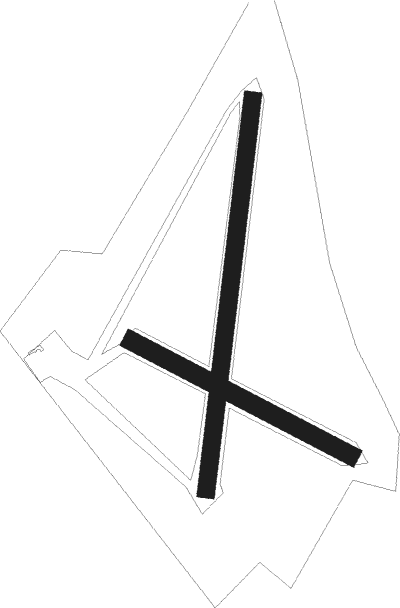
Runway info
Runway 11 / 29  | ||
| length | 499m (1637ft) | |
| bearing | 110° / 290° | |
| width | 38m (125ft) | |
| surface | grass | |
| Runway 01 / 19 | ||
| length | 795m (2608ft) | |
| bearing | 18° / 198° | |
| width | 36m (118ft) | |
| surface | grass | |
Nearby beacons
| code | identifier | dist | bearing | frequency |
|---|---|---|---|---|
| PAH | SCHWERIN-PARCHIM NDB | 13.7 | 155° | 315 |
| PMD | DME | 13.9 | 130° | 117.50 |
| PI | SCHWERIN-PARCHIM NDB | 15.4 | 114° | 333 |
| LAG | LAAGE TACAN | 31.5 | 67° | 108.25 |
| LYE | LUEBECK NDB | 32.7 | 282° | 394 |
| BKD | BRUENKENDORF VOR/DME | 34.8 | 181° | 117.70 |
Disclaimer
The information on this website is not for real aviation. Use this data with the X-Plane flight simulator only! Data taken with kind consent from X-Plane 12 source code and data files. Content is subject to change without notice.