Rothenburg/oberlausitz - Rothenburg/görlitz
Airport details
| Country | Germany |
| State | Saxony |
| Region | ED |
| Airspace | Munich Ctr |
| Municipality | Rothenburg/Oberlausitz |
| Elevation | 518ft (158m) |
| Timezone | GMT +1 |
| Coordinates | 51.36317, 14.95000 |
| Magnetic var | |
| Type | land |
| Available since | X-Plane v10.40 |
| ICAO code | EDBR |
| IATA code | n/a |
| FAA code | n/a |
Communication
| Rothenburg/Görlitz Rothenburg Info | 123.255 |
Nearby Points of Interest:
Kirche Hähnichen
-Bahnhof Horka Gbf
-Schloss Daubitz
-Evangelische Kirche Niesky
-Kirche Kosel
-Przewóz Castle
-Trinitatiskirche
-Schloss Niederrengersdorf
-Kirche Niederrengersdorf
-Kościół ewangelicki w Ruszowie
-Neues Schloss Ober Rengersdorf
-Königshainer Schlösser
-Königshainer Schlösser (Sachgesamtheit) Dorfstraße 27; 28; 28a; 29; 30; 30b; 31; 31a; 32
-Manor in Jędrzychowice
-Kirche Förstgen
-Palace in Żarska Wieś
-Rittergut Arnsdorf
-Städtischer Friedhof Görlitz
-Nikolaiturm
-Jägerkaserne
-Wheelwright Croft in Zgorzelec
-Palace in Iłowa
-Schloss Döbschütz
-Brautwiesenplatz
-Stadthalle Görlitz
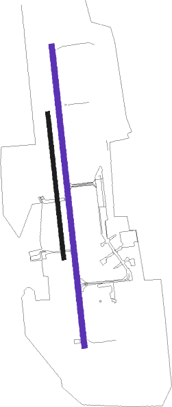
Runway info
| Runway 17 / 35 | ||
| length | 2498m (8196ft) | |
| bearing | 177° / 357° | |
| width | 45m (148ft) | |
| surface | asphalt | |
Runway 17R / 35L  | ||
| length | 1207m (3960ft) | |
| bearing | 177° / 357° | |
| width | 35m (115ft) | |
| surface | grass | |
Nearby beacons
| code | identifier | dist | bearing | frequency |
|---|---|---|---|---|
| OKX | FRYDLANT VOR/DME | 27.8 | 170° | 114.85 |
| HDO | HERMSDORF VOR/DME | 34 | 233° | 108.65 |
| ZLG | ZIELONA GORA VOR/DME | 56.4 | 48° | 110.65 |
| NER | NERATOVICE VOR/DME | 61.1 | 198° | 112.25 |
Disclaimer
The information on this website is not for real aviation. Use this data with the X-Plane flight simulator only! Data taken with kind consent from X-Plane 12 source code and data files. Content is subject to change without notice.