Airports for X-Plane offers a convenient way to explore airports and their related communication information for the X-Plane flight simulator. It only uses data from the X-Plane flight simulator itself, and is therefore more reliable than the data that comes from real aviation websites. You can search for airports by using the ICAO code, or browse for airports per country and state. The information displayed is categorized by airport details, runway information, airport communication, approach frequencies (ILS and Glidepath details), details of nearby beacons, SIDs, STARs and approach procedures.

nearby nation faa plane air traffic control rail transport tarmac immigration ferry metro public transport stolport southwest gravel helipad grass control tower near hospital concrete

Kölleda - Sömmerda-dermsdorf

Airport details

CountryGermany
StateThuringia
RegionED
AirspaceMunich Ctr
MunicipalityKölleda
Elevation451ft (137m)
TimezoneGMT +1
Coordinates51.19786, 11.19653
Magnetic var
Typeland
Available sinceX-Plane v10.40
ICAO codeEDBS
IATA coden/a
FAA coden/a

Communication

Sömmerda-Dermsdorf Sömmerda Info124.000
Nearby Points of Interest:
Leubingen tumulus
-
St. Nikolaus
-
Saint Michael Church (Griefstedt)
-
Salvator Church
-
St. Petri und Pauli
-
Rathaus Weißensee
-
St. Peter und Paul
-
St. Trinitatis
-
Stadtkirche St. Ulrich (Kindelbrück)
-
St. Maria (Nausiß)
-
Kirche Bachra
-
Church in Dielsdorf (Schloßvippach)
-
Saint Martin Church (Herrnschwende)
-
Church of Frömmstedt
-
Church in Haindorf (Krautheim)
-
Saint Kilian Church
-
Saints Peter and Paul Church
-
Stadtkirche Unserer Lieben Frauen
-
St. Petri
-
Dorfkirche Ballstedt
-
St. Johannes Baptista (Hardisleben)
-
Schloss Hardisleben
-
Dorfkirche Ottmannshausen
-
Saint John the Baptist Church
-
Protestant Church (Hottelstedt)

Runway info

Runway 07 / 25
 length926m (3038ft)
 bearing78° / 258°
 width40m (131ft)
 surfacegrass
 displ threshold0m (0ft) / 145m (476ft)

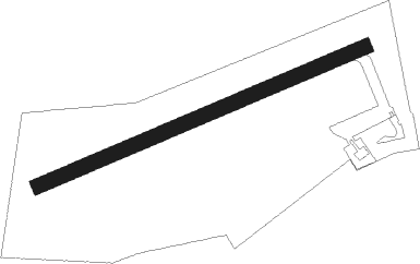
Airport layout


Nearby beacons

codeidentifierdistbearingfrequency
ERFERFURT VOR/DME14.9171°113.85
EFDDME15.7228°112.05
GOTGOTEM VOR/DME17.470°115.25
CBCOCHSTEDT NDB40.921°344
MAGMAGDEBURG VOR/DME52.837°110.45

Disclaimer

The information on this website is not for real aviation. Use this data with the X-Plane flight simulator only! Data taken with kind consent from X-Plane 12 source code and data files. Content is subject to change without notice.