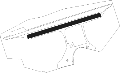
Schwarzheide - Schwarzheide - Schipkau
Airport details
| Country | Germany |
| State | Brandenburg |
| Region | ED |
| Airspace | Munich Ctr |
| Municipality | Schipkau |
| Elevation | 331ft (101m) |
| Timezone | GMT +1 |
| Coordinates | 51.48983, 13.87933 |
| Magnetic var | |
| Type | land |
| Available since | X-Plane v10.40 |
| ICAO code | EDBZ |
| IATA code | n/a |
| FAA code | n/a |
Communication
| Schwarzheide - Schipkau Schwarzheide Info | 129.975 |
Nearby Points of Interest:
Marktplatz in Ruhland
-Henrietten-Kirche
-Gutshaus Schwarzbach
-Friedensgedächtniskirche
-Schachtanlage Klettwitz
-Herz-Jesu-Kirche in Klettwitz
-Bagger 1473
-Grundschule Lauchhammer-Süd
-Christus-König-Kirche (Lauchhammer)
-Schloss Guteborn
-Lutherkirche
-Bergbauhaus
-Mahnmal für die Opfer des Faschismus und Militarismus in Senftenberg
-Schloss Senftenberg
-Wendische Kirche
-Amtsgericht Senftenberg
-Schlosskirche Lauchhammer
-Village church Hosena
-Dorfkirche Hohenbocka
-Dorfkirche Sallgast
-Village church Freienhufen
-Village church Großkoschen
-Dorfkirche Kroppen
-Dorfkirche Wormlage
-Dorfkirche Sedlitz
Nearby beacons
| code | identifier | dist | bearing | frequency |
|---|---|---|---|---|
| FS | DRESDEN NDB | 17.8 | 186° | 374 |
| DND | DME | 22.1 | 199° | 115.40 |
| DRN | DRESDEN VOR/DME | 30.3 | 211° | 114.35 |
| HOZ | HOLZDORF TACAN | 30.3 | 292° | 117.25 |
| HOZ | HOLZDORF NDB | 33.6 | 290° | 406 |
| KLF | KLASDORF VOR/DME | 33.9 | 329° | 115.15 |
| HDO | HERMSDORF VOR/DME | 38.4 | 139° | 108.65 |
| BBI | BERLIN BRANDENBURG VOR/DME | 53.5 | 333° | 114.10 |
| SDD | DME | 54.9 | 337° | 114.40 |
| FWE | FUERSTENWALDE VOR/DME | 56.1 | 15° | 113.30 |
Disclaimer
The information on this website is not for real aviation. Use this data with the X-Plane flight simulator only! Data taken with kind consent from X-Plane 12 source code and data files. Content is subject to change without notice.