Ballenstedt - Ballenstedt-harz
Airport details
| Country | Germany |
| State | Saxony-Anhalt |
| Region | ED |
| Airspace | Munich Ctr |
| Municipality | Ballenstedt |
| Elevation | 500ft (152m) |
| Timezone | GMT +1 |
| Coordinates | 51.74633, 11.23100 |
| Magnetic var | |
| Type | land |
| Available since | X-Plane v10.32 |
| ICAO code | EDCB |
| IATA code | n/a |
| FAA code | n/a |
Communication
| Ballenstedt-Harz Ballenstedt Info | 122.700 |
Nearby Points of Interest:
Gersdorfer Burg
-Marktturm Ballenstedt
-Rathaus Ballenstedt
-Schlossteich
-Neuer Teich
-Schulungszentrum Großer Ziegenberg
-Grenzstein
-Wilhelm-Pieck-Straße 16
-Holländermühle Gernrode
-Osterhöhe 53
-Große Wellbachsmühle
-Otto-Franke-Straße 16
-Städtisches Gas- und Elektrizitätswerk Gernrode
-Kriegerdenkmal Meisdorf
-Töpferstieg 17
-Badeborner Weg 16 (Quedlinburg)
-Walther-Rathenau-Straße 2
-Villa Irma
-Junge Familie
-Otto-Franke-Straße 34
-Otto-Franke-Straße 38
-Otto-Franke-Straße 40
-Postamt Gernrode
-Wappenstein
-Mittelstraße 15
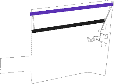
Runway info
| Runway 09 / 27 | ||
| length | 802m (2631ft) | |
| bearing | 88° / 268° | |
| width | 30m (98ft) | |
| surface | asphalt | |
| displ threshold | 60m (197ft) / 185m (607ft) | |
Runway 09R / 27L  | ||
| length | 706m (2316ft) | |
| bearing | 87° / 267° | |
| width | 30m (98ft) | |
| surface | grass | |
| displ threshold | 60m (197ft) / 85m (279ft) | |
Nearby beacons
| code | identifier | dist | bearing | frequency |
|---|---|---|---|---|
| CB | COCHSTEDT NDB | 10.6 | 63° | 344 |
| MAG | MAGDEBURG VOR/DME | 25.6 | 66° | 110.45 |
| GOT | GOTEM VOR/DME | 27.8 | 138° | 115.25 |
| HLZ | HEHLINGEN VOR/DME | 40.4 | 325° | 117.30 |
| BRU | BRAUNSCHWEIG-WOLFSBURG NDB | 41.5 | 313° | 427 |
| LND | NORTH(LEIPZIG- DME | 41.5 | 107° | 113.50 |
| LLD | SOUTH(LEIPZIG- DME | 42.2 | 108° | 112.15 |
| EFD | DME | 46.9 | 200° | 112.05 |
| ERF | ERFURT VOR/DME | 47.7 | 180° | 113.85 |
Disclaimer
The information on this website is not for real aviation. Use this data with the X-Plane flight simulator only! Data taken with kind consent from X-Plane 12 source code and data files. Content is subject to change without notice.