Eggersdorf - Eggersdorf - Muencheberg
Airport details
| Country | Germany |
| State | Brandenburg |
| Region | ED |
| Airspace | Bremen Ctr |
| Municipality | Müncheberg |
| Elevation | 220ft (67m) |
| Timezone | GMT +1 |
| Coordinates | 52.48283, 14.09083 |
| Magnetic var | |
| Type | land |
| Available since | X-Plane v10.40 |
| ICAO code | EDCE |
| IATA code | n/a |
| FAA code | n/a |
Communication
| Eggersdorf - Muencheberg Eggersdorf Info | 123.000 |
Nearby Points of Interest:
Village church in Eggersdorf
-Jüdischer Friedhof
-Village church Tempelberg
-Burgwall Waldsieversdorf
-Village church Beerfelde
-Water Tower Waldsieversdorf
-Village church Buchholz (Steinhöfel)
-Village church Jänickendorf
-Village church Obersdorf
-Village church Münchehofe (Müncheberg)
-Parish church in Buckow (Märkische Schweiz)
-Village church Kienbaum
-Village church Hasenfelde
-Village church Neuendorf im Sande
-Village church Bollersdorf
-Village church Hermersdorf
-Village church Kagel
-Village church Arensdorf
-Village church Demnitz
-Village church Wulkow (near Neuhardenberg)
-Rathaus
-Village church Grunow (Oberbarnim)
-Village church Klosterdorf (Oberbarnim)
-Ringenwalde church
-Church in Görlsdorf (Vierlinden)
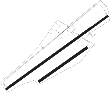
Runway info
Runway 06C / 24C  | ||
| length | 799m (2621ft) | |
| bearing | 70° / 250° | |
| width | 30m (98ft) | |
| surface | grass | |
| Runway 06R / 24L | ||
| length | 1078m (3537ft) | |
| bearing | 70° / 250° | |
| width | 50m (164ft) | |
| surface | grass | |
| Runway 06L / 24R | ||
| length | 1846m (6056ft) | |
| bearing | 70° / 250° | |
| width | 45m (148ft) | |
| surface | grass | |
| Runway 06 / 24 | ||
| length | 2343m (7687ft) | |
| bearing | 70° / 250° | |
| width | 35m (115ft) | |
| surface | asphalt | |
Nearby beacons
| code | identifier | dist | bearing | frequency |
|---|---|---|---|---|
| FWE | FUERSTENWALDE VOR/DME | 4.5 | 151° | 113.30 |
| SDD | DME | 22.4 | 260° | 114.40 |
| BBI | BERLIN BRANDENBURG VOR/DME | 24.8 | 258° | 114.10 |
| KLF | KLASDORF VOR/DME | 33.9 | 229° | 115.15 |
| LWB | LOEWENBERG VOR/DME | 43.2 | 294° | 114.55 |
| HOZ | HOLZDORF TACAN | 54.1 | 231° | 117.25 |
| HOZ | HOLZDORF NDB | 56.3 | 234° | 406 |
Disclaimer
The information on this website is not for real aviation. Use this data with the X-Plane flight simulator only! Data taken with kind consent from X-Plane 12 source code and data files. Content is subject to change without notice.