Chemnitz - Chemnitz/jahnsdorf
Airport details
| Country | Germany |
| State | Saxony |
| Region | ED |
| Airspace | Munich Ctr |
| Municipality | Jahnsdorf/Erzgebirge |
| Elevation | 1202ft (366m) |
| Timezone | GMT +1 |
| Coordinates | 50.74733, 12.83733 |
| Magnetic var | |
| Type | land |
| Available since | X-Plane v10.40 |
| ICAO code | EDCJ |
| IATA code | n/a |
| FAA code | n/a |
Communication
| Chemnitz/Jahnsdorf Jahnsdorf Info | 122.500 |
Nearby Points of Interest:
Haltepunkt Ursprung
-Bernhardsche Spinnerei
-St. Johannes
-Alte Kirche
-Johanneskirche (Chemnitz-Reichenbrand)
-Torell-Stein
-Kulturpalast Rabenstein
-Villa Hahn
-Villa Oscar Freiherr von Kohorn zu Kornegg
-Sachgesamtheit Rittergut Niederrabenstein
-Pfarrhaus, Georgenkirchweg 1 Chemnitz-Rabenstein
-Sachgesamtheit Matthäus-Friedhof
-Jüdische Leichenhalle, Chemnitz-Altendorf
-Stadtpark Chemnitz
-Einsiedler Brauhaus
-Schule Chemnitz-Reichenhain
-Christuskirche
-Reichsstraße 11. Chemnitz
-Altes Rathaus, Chemnitz
-DAStietz
-Hoher Turm
-Sowjetischer Friedhof
-Neues Rathaus, Chemnitz
-Markthalle Chemnitz
-Stadthalle Chemnitz
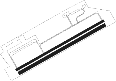
Runway info
Runway 07 / 25  | ||
| length | 898m (2946ft) | |
| bearing | 74° / 254° | |
| width | 20m (66ft) | |
| surface | asphalt | |
| Runway 07R / 25L | ||
| length | 881m (2890ft) | |
| bearing | 74° / 254° | |
| width | 30m (98ft) | |
| surface | grass | |
| displ threshold | 60m (197ft) / 40m (131ft) | |
Nearby beacons
| code | identifier | dist | bearing | frequency |
|---|---|---|---|---|
| AGD | DME | 18.7 | 306° | 115.30 |
| ABU | ALTENBURG NDB | 19 | 308° | 330 |
| DRN | DRESDEN VOR/DME | 33 | 71° | 114.35 |
| L | VRATA (KARLOVY VARY) NDB | 33.3 | 169° | 365 |
| DND | DME | 41.7 | 67° | 115.40 |
| LEG | LEIPZIG VOR/DME | 43.5 | 332° | 115.85 |
| OKG | CHEB VOR/DME | 44.1 | 212° | 115.70 |
| SKZ | SCHKEUDITZ (LEIPZIG-HALLE) NDB | 45.4 | 320° | 357 |
| LLD | SOUTH(LEIPZIG- DME | 46.1 | 318° | 112.15 |
| ZIG | LEIPZIG NDB | 46.2 | 321° | 340 |
| LND | NORTH(LEIPZIG- DME | 47.2 | 318° | 113.50 |
Disclaimer
The information on this website is not for real aviation. Use this data with the X-Plane flight simulator only! Data taken with kind consent from X-Plane 12 source code and data files. Content is subject to change without notice.