Wismar - Wismar-müggenburg
Airport details
| Country | Germany |
| State | Mecklenburg-Vorpommern |
| Region | ED |
| Airspace | Bremen Ctr |
| Municipality | Wismar |
| Elevation | 41ft (12m) |
| Timezone | GMT +1 |
| Coordinates | 53.91444, 11.49944 |
| Magnetic var | |
| Type | land |
| Available since | X-Plane v10.40 |
| ICAO code | EDCW |
| IATA code | n/a |
| FAA code | n/a |
Communication
| Wismar-Müggenburg Wismar Info | 123.050 |
Nearby Points of Interest:
Kruse-Speicher
-Thormann-Speicher
-Ohlerich-Speicher
-Townhall of Wismar
-Welt-Erbe-Haus (Wismar)
-IGS "Johann Wolfgang von Goethe"
-Cemetery of Wismar
-Schloss Gamehl
-Denkstein des Ludeke Mozellenburch
-Eiertunnel Bad Kleinen
-Stadtkirche Neubukow
-Malzfabrik Grevesmühlen
-Church in Moisall
-Burg Arpshagen
-Dorfkirche Laase
-Windmill in Kröpelin
-Herrenhaus Schönfeld
-Church in Satow
-Dorfkirche Baumgarten (Warnow)
-Burg Trechow
-Friedhof Sachsenberg
-Schloss Wedendorf
-Villa Baltic
-Volksschwimmhalle Lankow
-Rathaus Sternberg
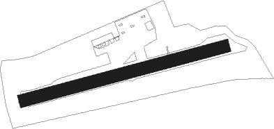
Runway info
| Runway 08 / 26 | ||
| length | 635m (2083ft) | |
| bearing | 84° / 264° | |
| width | 40m (131ft) | |
| surface | grass | |
Nearby beacons
| code | identifier | dist | bearing | frequency |
|---|---|---|---|---|
| LAG | LAAGE TACAN | 27.8 | 90° | 108.25 |
| LYE | LUEBECK NDB | 29.2 | 262° | 394 |
| PI | SCHWERIN-PARCHIM NDB | 30.8 | 138° | 333 |
| PMD | DME | 31 | 150° | 117.50 |
| PAH | SCHWERIN-PARCHIM NDB | 31.7 | 162° | 315 |
| BKD | BRUENKENDORF VOR/DME | 52.8 | 177° | 117.70 |
Disclaimer
The information on this website is not for real aviation. Use this data with the X-Plane flight simulator only! Data taken with kind consent from X-Plane 12 source code and data files. Content is subject to change without notice.