Hockenheim - Herrenteich
Airport details
| Country | Germany |
| State | Baden-Württemberg |
| Region | ED |
| Airspace | Langen Ctr |
| Municipality | Hockenheim |
| Elevation | 308ft (94m) |
| Timezone | GMT +1 |
| Coordinates | 49.34500, 8.48778 |
| Magnetic var | |
| Type | land |
| Available since | X-Plane v10.40 |
| ICAO code | EDEH |
| IATA code | n/a |
| FAA code | n/a |
Communication
| Herrenteich Herrenteich Info | 132.055 |
Nearby Points of Interest:
Stadthaus
-Johannesstraße 28
-Jewish courtyard
-St. Ludwig (Speyer)
-Amtsgericht Speyer
-Villa Kirrmeier-Ecarius
-Ägidienkirche, Speyer
-Jüdischer Friedhof Schwetzingen
-Wasserturm
-Schlösschen im Park
-Jüdischer Friedhof Walldorf
-Villa rustica bei Walldorf
-Altes Rathaus Mutterstadt
-Nachrichten Kaserne
-Stauwehr Wieblingen
-Castra of Wagbach
-Schleuse Feudenheim
-Lemle-Moses-Klaus
-Hauptsynagoge
-Marktplatzbrunnen (Mannheim)
-Bumiller-Villa, D 7, 5
-Deutsch-Amerikanisches Institut Heidelberg
-Dreifaltigkeitskirche
-Altes Rathaus
-Neunhellerhaus (Ladenburg)
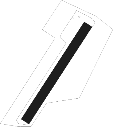
Runway info
| Runway 04 / 22 | ||
| length | 636m (2087ft) | |
| bearing | 50° / 230° | |
| width | 54m (178ft) | |
| surface | grass | |
| displ threshold | 0m (0ft) / 35m (115ft) | |
Nearby beacons
| code | identifier | dist | bearing | frequency |
|---|---|---|---|---|
| MND | DME | 7.6 | 13° | 113.55 |
| NKR | NECKAR NDB | 9.6 | 92° | 292 |
| KRH | KARLSRUHE VOR/DME | 21.4 | 165° | 115.95 |
| RID | RIED VOR/DME | 26.3 | 7° | 112.20 |
| RMS | RAMSTEIN TACAN | 35.6 | 276° | 113.40 |
| KBA | KARLSRUHE/BADEN-BADEN NDB | 36.2 | 216° | 431 |
| VFM | NAUHEIM VOR | 37 | 358° | 113.75 |
| KBD | DME | 37.3 | 215° | 115.80 |
| FW | FRANKFURT NDB | 39.6 | 355° | 382 |
| CHA | CHARLIE VOR/DME | 40.7 | 44° | 115.35 |
| FRD | DME | 41.2 | 7° | 115.90 |
| LBU | LUBURG VOR/DME | 42.3 | 117° | 109.20 |
| WIB | WIESBADEN TACAN | 42.6 | 346° | 114.10 |
| FFM | FRANKFURT VORTAC | 42.9 | 12° | 114.20 |
| FR | FRANKFURT NDB | 43.9 | 15° | 297 |
| SGD | DME | 48.9 | 132° | 115.45 |
| STG | STUTTGART VOR/DME | 49.3 | 130° | 116.85 |
| TGO | TANGO TACAN | 53.1 | 133° | 112.50 |
| SE | STRASBOURG NDB | 54.6 | 226° | 412 |
| TAU | TAUNUS VOR/DME | 55.8 | 340° | 113.35 |
| MTR | METRO VOR | 57.6 | 21° | 110 |
| SUL | SULZ VOR | 58.1 | 171° | 116.10 |
| STR | STRASBOURG ENTZHEIM VOR/DME | 62 | 227° | 115.60 |
| LRD | DME | 64.4 | 214° | 108.05 |
| LHR | LAHR NDB | 65.5 | 214° | 337 |
Disclaimer
The information on this website is not for real aviation. Use this data with the X-Plane flight simulator only! Data taken with kind consent from X-Plane 12 source code and data files. Content is subject to change without notice.