Langenlonsheim
Airport details
| Country | Germany |
| State | Rhineland-Palatinate |
| Region | ED |
| Airspace | Langen Ctr |
| Municipality | Langenlonsheim |
| Elevation | 294ft (90m) |
| Timezone | GMT +1 |
| Coordinates | 49.90833, 7.90767 |
| Magnetic var | |
| Type | land |
| Available since | X-Plane v10.40 |
| ICAO code | EDEL |
| IATA code | n/a |
| FAA code | n/a |
Communication
| Langenlonsheim Langenlonsheim Info | 122.875 |
Nearby Points of Interest:
Gasthaus „Zum Hohenzollern“
-Evangelische Pfarrkirche Langenlonsheim
-Synagoge Waldhilbersheim
-Kriegerdenkmal 1870/71 (Aspisheim)
-Villa Rustica
-Jakobsberg Priory
-Kloster Rupertsberg
-Neue Synagoge
-Evangelische Kirche Waldalgesheim
-Evangelische Kirche Genheim
-St. Mariä Himmelfahrt
-Alte Nahebrücke (Bad Kreuznach)
-Brömserhof
-Rittergut Bangert
-Landschaftspark Niederwald
-Eberbacher Hof
-Kronberger Hof
-Palais Ostein
-Rathaus (Appenheim)
-Alte Werkshalle
-Kurhaus Stromberg
-Schloss Westerhaus
-Burg Johannisberg
-Wöllstein water tower
-Schiefer Turm von Gau-Weinheim
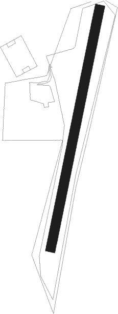
Runway info
| Runway 01 / 19 | ||
| length | 747m (2451ft) | |
| bearing | 24° / 204° | |
| width | 30m (98ft) | |
| surface | grass | |
Nearby beacons
| code | identifier | dist | bearing | frequency |
|---|---|---|---|---|
| WIB | WIESBADEN TACAN | 17.6 | 71° | 114.10 |
| FW | FRANKFURT NDB | 20.9 | 80° | 382 |
| VFM | NAUHEIM VOR | 22 | 85° | 113.75 |
| TAU | TAUNUS VOR/DME | 22.7 | 37° | 113.35 |
| HAN | HAHN NDB | 24.4 | 275° | 376 |
| FHH | DME | 25 | 273° | 117.35 |
| RID | RIED VOR/DME | 25.6 | 101° | 112.20 |
| FRD | DME | 26.5 | 80° | 115.90 |
| FFM | FRANKFURT VORTAC | 29.4 | 79° | 114.20 |
| RMS | RAMSTEIN TACAN | 31 | 214° | 113.40 |
| FR | FRANKFURT NDB | 31.4 | 79° | 297 |
| MND | DME | 35.3 | 126° | 113.55 |
| BUE | BUECHEL TACAN | 36.1 | 288° | 117.10 |
| MTR | METRO VOR | 42.4 | 69° | 110 |
| ZWN | ZWEIBRUECKEN VOR/DME | 45 | 216° | 114.80 |
| NKR | NECKAR NDB | 47 | 125° | 292 |
| SIL | SIEGERLAND NDB | 47.1 | 17° | 489 |
| SLD | DME | 48.3 | 12° | 108.05 |
| SR | ENSHEIM (SAARBRUECKEN) NDB | 49.3 | 225° | 360 |
| SAD | DME | 51.9 | 229° | 116.75 |
| COL | COLA VOR/DME | 53.9 | 340° | 108.80 |
| LV | COLOGNE-BONN NDB | 59.5 | 323° | 327 |
| KRH | KARLSRUHE VOR/DME | 60.9 | 144° | 115.95 |
| KBO | COLOGNE-BONN VOR/DME | 64.2 | 321° | 112.15 |
| LW | COLOGNE-BONN NDB | 64.5 | 327° | 300 |
Disclaimer
The information on this website is not for real aviation. Use this data with the X-Plane flight simulator only! Data taken with kind consent from X-Plane 12 source code and data files. Content is subject to change without notice.