Homburg - Homberg Mosenberg
Airport details
| Country | Germany |
| State | Hesse |
| Region | ED |
| Airspace | Langen Ctr |
| Municipality | Falkenberg |
| Elevation | 1314ft (401m) |
| Timezone | GMT +1 |
| Coordinates | 51.06283, 9.42200 |
| Magnetic var | |
| Type | land |
| Available since | X-Plane v10.40 |
| ICAO code | EDEM |
| IATA code | n/a |
| FAA code | n/a |
Communication
| Homberg Mosenberg Mosenberg Info | 130.660 |
Nearby Points of Interest:
Schloss Melsungen
-Mader Heide
-Johanneskirche (Arnsbach)
-Ringwallanlagen Odenberg
-Kirche Allendorf an der Landsburg
-Evangelische Kirche Kirchbauna
-Evangelische Kirche Christerode
-Wallburg Großenritte
-Bahnhof Baunatal-Großenritte
-Ziegenhain fortress
-Evangelische Kirche Altwildungen
-Alheimerturm
-Rotenburg Castle
-Heilig-Geist-Hospital Treysa
-Altes Burghaus Schrecksbach
-Frühstückspavillon
-Evangelische Kirche Battenhausen
-Gräfestraße 16
-Wilhelmshöher Allee 118
-Stadthalle Kassel
-Dörnbergstraße 2 (Kassel)
-Elisabethhospital (Kassel)
-Zwehrenturm
-Palais Reichenbach
-Ständehaus Kassel
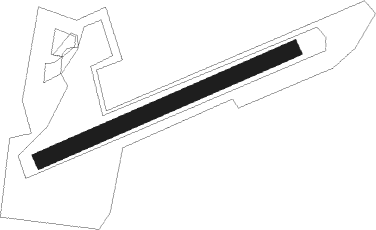
Runway info
| Runway 07 / 25 | ||
| length | 504m (1654ft) | |
| bearing | 78° / 258° | |
| width | 30m (98ft) | |
| surface | grass | |
Nearby beacons
| code | identifier | dist | bearing | frequency |
|---|---|---|---|---|
| FTZ | FRITZLAR NDB | 1.3 | 342° | 468 |
| DKS | DME-ILS | 21.5 | 357° | 111.50 |
| FUL | FULDA VOR/DME | 28.8 | 162° | 112.10 |
| WRB | WARBURG VOR/DME | 29 | 325° | 113.70 |
| GED | GEDERN VORTAC | 39.6 | 195° | 110.80 |
| PAD | DME-ILS | 44.5 | 304° | 108.50 |
| PAD | PADERBORN-LIPPSTADT NDB | 44.6 | 306° | 354 |
| MTR | METRO VOR | 52 | 216° | 110 |
| FR | FRANKFURT NDB | 66.1 | 217° | 297 |
Disclaimer
The information on this website is not for real aviation. Use this data with the X-Plane flight simulator only! Data taken with kind consent from X-Plane 12 source code and data files. Content is subject to change without notice.