Gersfeld - Wasserkuppe
Airport details
| Country | Germany |
| State | Hesse |
| Region | ED |
| Airspace | Langen Ctr |
| Municipality | Gersfeld |
| Elevation | 2956ft (901m) |
| Timezone | GMT +1 |
| Coordinates | 50.49778, 9.94944 |
| Magnetic var | |
| Type | land |
| Available since | X-Plane v10.40 |
| ICAO code | EDER |
| IATA code | n/a |
| FAA code | n/a |
Communication
| Wasserkuppe Wasserkuppe Info | 118.650 |
Nearby Points of Interest:
Doppelturmhügel Oberweißenbrunn
-Pfarrkirche
-St. Josef
-Filialkirche
-Wallfahrtskirche
-St. Kilian
-Jewish cemetery, Oberwaldbehrungen
-St. Georg (Ketten)
-St. Laurentius (Schönau an der Brend)
-Pfarrhaus
-Rhön Biosphere Reserve
-Kirche
-Burgruine
-Kuratiekirche
-Church of the Assumption
-Richthalle Fulda
-Fulda
-Palais Altenstein
-Protestant Church Klings
-Propstei Johannesberg
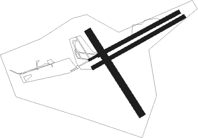
Runway info
Runway 06 / 24  | ||
| length | 644m (2113ft) | |
| bearing | 74° / 254° | |
| width | 15m (49ft) | |
| surface | asphalt | |
| Runway 15 / 33 | ||
| length | 691m (2267ft) | |
| bearing | 140° / 320° | |
| width | 50m (164ft) | |
| surface | grass | |
| Runway 06R / 24L | ||
| length | 743m (2438ft) | |
| bearing | 74° / 254° | |
| width | 30m (98ft) | |
| surface | grass | |
| Runway 06C / 24C | ||
| length | 646m (2119ft) | |
| bearing | 74° / 254° | |
| width | 30m (98ft) | |
| surface | grass | |
Nearby beacons
| code | identifier | dist | bearing | frequency |
|---|---|---|---|---|
| FUL | FULDA VOR/DME | 15.4 | 284° | 112.10 |
| GED | GEDERN VORTAC | 27.2 | 263° | 110.80 |
| FTZ | FRITZLAR NDB | 40.6 | 318° | 468 |
| CHA | CHARLIE VOR/DME | 49.2 | 238° | 115.35 |
| DKS | DME-ILS | 59.1 | 329° | 111.50 |
Disclaimer
The information on this website is not for real aviation. Use this data with the X-Plane flight simulator only! Data taken with kind consent from X-Plane 12 source code and data files. Content is subject to change without notice.