Griesheim - Darmstadt Griesheim
Airport details
| Country | Germany |
| State | Hesse |
| Region | ED |
| Airspace | Langen Ctr |
| Municipality | Darmstadt |
| Elevation | 333ft (101m) |
| Timezone | GMT +1 |
| Coordinates | 49.85472, 8.58667 |
| Magnetic var | |
| Type | land |
| Available since | X-Plane v10.40 |
| ICAO code | EDES |
| IATA code | n/a |
| FAA code | n/a |
Communication
| Darmstadt Griesheim Tower | 128.800 |
Nearby Points of Interest:
Windkanal
-Wilhelm-Leuschner-Straße 217
-Wilhelm-Leuschner-Straße 58
-Bessunger Straße 51
-Wilhelm-Leuschner-Straße 13
-Friedhof Griesheim
-Grabmal Erasmus Kittler
-Groß-Gerauer-Straße 16
-Grabmal Familie Gissinger
-Grabmal Max Edler von Planitz
-Grabmal August Buxbaum
-Oberndorfstraße 1
-Grabmal Albin Müller
-Kreuzgasse 10
-Grabmal Willy Merck
-Französisches Kriegsgefangenendenkmal
-Groß-Gerauer-Straße 38
-Sachgesamtheit Waldfriedhof
-Pfarrhaus
-Pfützenstraße 15
-Grabmal ehemals Ludwig Wagner
-Pfützenstraße 8
-Grabmal Familie Schmitz
-Grabmal Eugen Bracht
-Grabmal Familie Ehrenhard
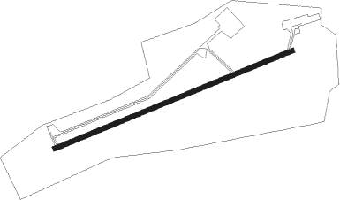
Runway info
| Runway 07 / 25 | ||
| length | 1153m (3783ft) | |
| bearing | 78° / 258° | |
| width | 20m (66ft) | |
| surface | asphalt | |
| displ threshold | 0m (0ft) / 193m (633ft) | |
Nearby beacons
| code | identifier | dist | bearing | frequency |
|---|---|---|---|---|
| RID | RIED VOR/DME | 4.7 | 212° | 112.20 |
| VFM | NAUHEIM VOR | 7.8 | 313° | 113.75 |
| FRD | DME | 10.5 | 354° | 115.90 |
| FW | FRANKFURT NDB | 10.8 | 314° | 382 |
| FFM | FRANKFURT VORTAC | 12.1 | 14° | 114.20 |
| FR | FRANKFURT NDB | 13.2 | 25° | 297 |
| WIB | WIESBADEN TACAN | 15.6 | 305° | 114.10 |
| CHA | CHARLIE VOR/DME | 17.9 | 82° | 115.35 |
| MND | DME | 23.2 | 190° | 113.55 |
| MTR | METRO VOR | 27.2 | 32° | 110 |
| TAU | TAUNUS VOR/DME | 28.8 | 313° | 113.35 |
| NKR | NECKAR NDB | 31.6 | 164° | 292 |
| GED | GEDERN VORTAC | 42 | 50° | 110.80 |
| KRH | KARLSRUHE VOR/DME | 51.7 | 180° | 115.95 |
| SIL | SIEGERLAND NDB | 52.4 | 331° | 489 |
| SLD | DME | 54.7 | 329° | 108.05 |
| FUL | FULDA VOR/DME | 58.2 | 53° | 112.10 |
| LBU | LUBURG VOR/DME | 63.7 | 141° | 109.20 |
| COL | COLA VOR/DME | 67.5 | 313° | 108.80 |
Disclaimer
The information on this website is not for real aviation. Use this data with the X-Plane flight simulator only! Data taken with kind consent from X-Plane 12 source code and data files. Content is subject to change without notice.