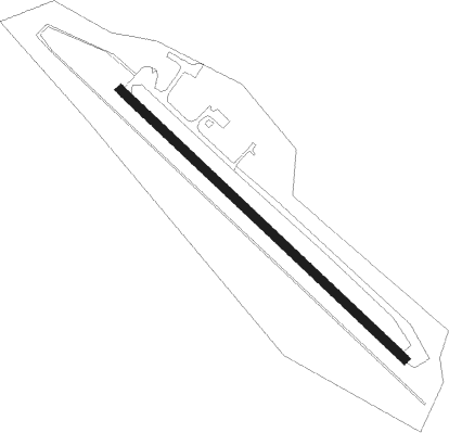
Bad Neustadt A.d.saale - Bad Neustadt/saale Grasberg
Airport details
| Country | Germany |
| State | Bavaria |
| Region | ED |
| Airspace | Langen Ctr |
| Municipality | Salz |
| Elevation | 997ft (304m) |
| Timezone | GMT +1 |
| Coordinates | 50.30550, 10.22650 |
| Magnetic var | |
| Type | land |
| Available since | X-Plane v10.40 |
| ICAO code | EDFD |
| IATA code | n/a |
| FAA code | n/a |
Communication
| Bad Neustadt/Saale Grasberg Neustadt Saale Info | 123.650 |
Nearby Points of Interest:
Monastery Neustadt an der Saale
-Pfarrkirche
-Kapelle
-Altar
-Kloster
-Kirche
-St. Michael
-Rathaus
-Mariä Geburt
-Pfarrhaus
-Pfarrhof
-Wegkreuz
-Basilika
-Riemenschneider-Kruzifix
-Burgruine
-St. Bartholomäus (Haard)
-Filialkirche
-Kuratiekirche
-Frickenhäuser See
-Wegkapelle
-Rathaus Nüdlingen
Nearby beacons
| code | identifier | dist | bearing | frequency |
|---|---|---|---|---|
| FUL | FULDA VOR/DME | 30.3 | 294° | 112.10 |
| GED | GEDERN VORTAC | 37.9 | 276° | 110.80 |
| EFD | DME | 49.2 | 47° | 112.05 |
| ILM | ILLESHEIM NDB | 50.4 | 169° | 488 |
| ERL | ERLANGEN VOR/DME | 52.9 | 125° | 114.90 |
| NSN | NIEDERSTETTEN NDB | 55.6 | 196° | 311 |
| NDD | DME-ILS | 55.7 | 196° | 108.70 |
| FTZ | FRITZLAR NDB | 56 | 314° | 468 |
| NUB | NUERNBERG VOR/DME | 57.4 | 135° | 115.75 |
| NGD | DME | 58.5 | 133° | 113.10 |
| ANS | ANSBACH NDB | 61.8 | 158° | 452 |
Disclaimer
The information on this website is not for real aviation. Use this data with the X-Plane flight simulator only! Data taken with kind consent from X-Plane 12 source code and data files. Content is subject to change without notice.