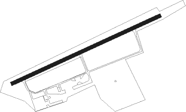
Gießen - Giessen - Luetzellinden
Airport details
| Country | Germany |
| State | Hesse |
| Region | ED |
| Airspace | Langen Ctr |
| Municipality | Gießen |
| Elevation | 750ft (229m) |
| Timezone | GMT +1 |
| Coordinates | 50.54383, 8.59017 |
| Magnetic var | |
| Type | land |
| Available since | X-Plane v10.40 |
| ICAO code | EDFL |
| IATA code | n/a |
| FAA code | n/a |
Communication
| Giessen - Luetzellinden Luetzellinden Info | 122.500 |
Nearby beacons
| code | identifier | dist | bearing | frequency |
|---|---|---|---|---|
| MTR | METRO VOR | 18.8 | 136° | 110 |
| SIL | SIEGERLAND NDB | 19 | 287° | 489 |
| SLD | DME | 21.8 | 288° | 108.05 |
| TAU | TAUNUS VOR/DME | 24 | 236° | 113.35 |
| GED | GEDERN VORTAC | 26.4 | 101° | 110.80 |
| FR | FRANKFURT NDB | 28.9 | 169° | 297 |
| FFM | FRANKFURT VORTAC | 29.4 | 175° | 114.20 |
| FRD | DME | 30.8 | 182° | 115.90 |
| WIB | WIESBADEN TACAN | 31.7 | 209° | 114.10 |
| FW | FRANKFURT NDB | 32.9 | 197° | 382 |
| VFM | NAUHEIM VOR | 35.2 | 192° | 113.75 |
| FUL | FULDA VOR/DME | 37.5 | 87° | 112.10 |
| COL | COLA VOR/DME | 40.5 | 284° | 108.80 |
| CHA | CHARLIE VOR/DME | 41.1 | 144° | 115.35 |
| FTZ | FRITZLAR NDB | 45 | 57° | 468 |
| RID | RIED VOR/DME | 45.8 | 184° | 112.20 |
| GMH | GERMINGHAUSEN VOR/DME | 46 | 312° | 115.40 |
| DKS | DME-ILS | 61 | 43° | 111.50 |
| WRB | WARBURG VOR/DME | 61 | 28° | 113.70 |
| DOR | WICKEDE (DORTMUND) VOR/DME | 69.1 | 316° | 108.65 |
| DWI | DORTMUND-WICKEDE NDB | 69.1 | 316° | 357 |
Disclaimer
The information on this website is not for real aviation. Use this data with the X-Plane flight simulator only! Data taken with kind consent from X-Plane 12 source code and data files. Content is subject to change without notice.
