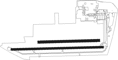
Mannheim - Mannheim City
Airport details
| Country | Germany |
| State | Baden-Württemberg |
| Region | ED |
| Airspace | Langen Ctr |
| Municipality | Mannheim |
| Elevation | 309ft (94m) |
| Timezone | GMT +1 |
| Coordinates | 49.47271, 8.51426 |
| Magnetic var | |
| Type | land |
| Available since | X-Plane v10.40 |
| ICAO code | EDFM |
| IATA code | MHG |
| FAA code | n/a |
Communication
| Mannheim City MANNHEIM ATIS | 136.550 |
| Mannheim City MANNHEIM INFO | 122.500 |
| Mannheim City MANNHEIM Tower | 129.775 |
Approach frequencies
| LOC | RW27 | 108.55 | 18.00mi |
Nearby beacons
| code | identifier | dist | bearing | frequency |
|---|---|---|---|---|
| MND | DME | 0.1 | 140° | 113.55 |
| NKR | NECKAR NDB | 11.8 | 122° | 292 |
| RID | RIED VOR/DME | 18.5 | 5° | 112.20 |
| KRH | KARLSRUHE VOR/DME | 28.9 | 172° | 115.95 |
| VFM | NAUHEIM VOR | 29.4 | 355° | 113.75 |
| FW | FRANKFURT NDB | 32.1 | 351° | 382 |
| FRD | DME | 33.5 | 6° | 115.90 |
| CHA | CHARLIE VOR/DME | 33.7 | 50° | 115.35 |
| FFM | FRANKFURT VORTAC | 35.2 | 12° | 114.20 |
| WIB | WIESBADEN TACAN | 35.3 | 340° | 114.10 |
| FR | FRANKFURT NDB | 36.2 | 16° | 297 |
| RMS | RAMSTEIN TACAN | 36.3 | 268° | 113.40 |
| KBA | KARLSRUHE/BADEN-BADEN NDB | 43.7 | 212° | 431 |
| KBD | DME | 44.8 | 212° | 115.80 |
| LBU | LUBURG VOR/DME | 46.7 | 124° | 109.20 |
| TAU | TAUNUS VOR/DME | 48.6 | 336° | 113.35 |
| MTR | METRO VOR | 49.9 | 23° | 110 |
| SGD | DME | 54.7 | 138° | 115.45 |
| STG | STUTTGART VOR/DME | 55 | 136° | 116.85 |
| TGO | TANGO TACAN | 59 | 139° | 112.50 |
| SE | STRASBOURG NDB | 61.7 | 222° | 412 |
| GED | GEDERN VORTAC | 63.1 | 38° | 110.80 |
| STR | STRASBOURG ENTZHEIM VOR/DME | 68.9 | 224° | 115.60 |
Departure and arrival routes
| Transition altitude | 5000ft |
| SID end points | distance | outbound heading | |
|---|---|---|---|
| RW09 | |||
| ROLS3C | 32mi | 99° | |
| UMDA3C | 13mi | 104° | |
| MANE8C | 17mi | 241° | |
| OLIV6C | 40mi | 289° | |
| RW27 | |||
| ROLS3W | 32mi | 99° | |
| UMDA3W | 13mi | 104° | |
| MANE8W | 17mi | 241° | |
| OLIV4W | 40mi | 289° | |
Instrument approach procedures
| runway | airway (heading) | route (dist, bearing) |
|---|---|---|
| RW27 | KETEG (272°) | KETEG 5000ft FM001 (3mi, 275°) 5000ft |
| RW27 | RINEX (320°) | RINEX 5000ft NKR (4mi, 86°) 5000ft FM002 (8mi, 73°) 5000ft FM001 (4mi, 5°) 5000ft |
| RNAV | FM001 5000ft EPOMA (4mi, 272°) 5000ft EDFM (12mi, 272°) 356ft FM003 (5mi, 263°) FM004 (6mi, 205°) FM005 (4mi, 128°) RINEX (9mi, 85°) 5000ft |
Disclaimer
The information on this website is not for real aviation. Use this data with the X-Plane flight simulator only! Data taken with kind consent from X-Plane 12 source code and data files. Content is subject to change without notice.

