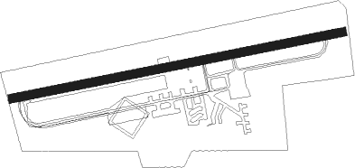
Michelstadt - Michelstadt Odenwald
Airport details
| Country | Germany |
| State | Hesse |
| Region | ED |
| Airspace | Langen Ctr |
| Municipality | Michelstadt |
| Elevation | 1143ft (348m) |
| Timezone | GMT +1 |
| Coordinates | 49.67850, 8.97233 |
| Magnetic var | |
| Type | land |
| Available since | X-Plane v10.40 |
| ICAO code | EDFO |
| IATA code | n/a |
| FAA code | n/a |
Communication
| Michelstadt Odenwald Michelstadt Info | 124.515 |
Nearby Points of Interest:
Marktplatz 6
-Alte Brauerei
-Rathaus Michelstadt
-Burgmannenhaus Pavey
-Habermannsburg
-Friedhof Michelstadt
-Evangelische Kirche Bad König
-Schloss Bad König
-Jagdschloß Eulbach
-Olfener Bild
-Rathaus
-Krähbergtunnel
-Pretlack’sches Palais
-Burg Lützelbach
-Bahnhof Fürth
-Jagdschloss Gammelsbach
-Jagdschloesschen Carlsruhe
-Evangelische Kirche Sandbach
-Hohlstraße 9 (Sandbach)
-Marktplatz 11 (Breuberg)
-Schloss Laudenbach (Unterfranken)
-Friedhof
-Ernst-Ludwig-Heilstätte
-Burg Frankenberg
Nearby beacons
| code | identifier | dist | bearing | frequency |
|---|---|---|---|---|
| CHA | CHARLIE VOR/DME | 14.8 | 16° | 115.35 |
| RID | RIED VOR/DME | 17.8 | 283° | 112.20 |
| MND | DME | 21.7 | 246° | 113.55 |
| NKR | NECKAR NDB | 22.5 | 215° | 292 |
| FR | FRANKFURT NDB | 25.8 | 323° | 297 |
| VFM | NAUHEIM VOR | 25.8 | 299° | 113.75 |
| FFM | FRANKFURT VORTAC | 26 | 318° | 114.20 |
| FRD | DME | 26.2 | 311° | 115.90 |
| FW | FRANKFURT NDB | 28.7 | 301° | 382 |
| WIB | WIESBADEN TACAN | 33.8 | 299° | 114.10 |
| MTR | METRO VOR | 36.2 | 348° | 110 |
| NDD | DME-ILS | 42.1 | 106° | 108.70 |
| NSN | NIEDERSTETTEN NDB | 42.2 | 106° | 311 |
| KRH | KARLSRUHE VOR/DME | 43.8 | 210° | 115.95 |
| GED | GEDERN VORTAC | 45.3 | 21° | 110.80 |
| SHD | HALL DME | 46.1 | 125° | 108.05 |
| TAU | TAUNUS VOR/DME | 46.4 | 305° | 113.35 |
| LBU | LUBURG VOR/DME | 48.1 | 154° | 109.20 |
| FUL | FULDA VOR/DME | 59.5 | 33° | 112.10 |
| STG | STUTTGART VOR/DME | 60 | 164° | 116.85 |
| SGD | DME | 60.3 | 166° | 115.45 |
| KBA | KARLSRUHE/BADEN-BADEN NDB | 63 | 225° | 431 |
| KBD | DME | 64.1 | 225° | 115.80 |
Disclaimer
The information on this website is not for real aviation. Use this data with the X-Plane flight simulator only! Data taken with kind consent from X-Plane 12 source code and data files. Content is subject to change without notice.