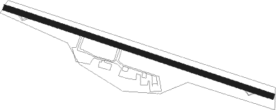
Allendorf - Allendorf Eder
Airport details
| Country | Germany |
| State | Hesse |
| Region | ED |
| Airspace | Langen Ctr |
| Municipality | Allendorf (Eder) |
| Elevation | 1164ft (355m) |
| Timezone | GMT +1 |
| Coordinates | 51.03537, 8.68086 |
| Magnetic var | |
| Type | land |
| Available since | X-Plane v10.30 |
| ICAO code | EDFQ |
| IATA code | n/a |
| FAA code | n/a |
Communication
| Allendorf Eder ATIS | 118.825 |
| Allendorf Eder Allendorf Info | 118.175 |
Runway info
| Runway 11 / 29 | ||
| length | 1536m (5039ft) | |
| bearing | 105° / 285° | |
| width | 30m (98ft) | |
| surface | asphalt | |
| displ threshold | 140m (459ft) / 149m (489ft) | |
Nearby beacons
| code | identifier | dist | bearing | frequency |
|---|---|---|---|---|
| FTZ | FRITZLAR NDB | 27.8 | 86° | 468 |
| SIL | SIEGERLAND NDB | 29.6 | 237° | 489 |
| SLD | DME | 30.1 | 241° | 108.05 |
| GMH | GERMINGHAUSEN VOR/DME | 30.8 | 280° | 115.40 |
| WRB | WARBURG VOR/DME | 32.5 | 42° | 113.70 |
| PAD | DME-ILS | 34.6 | 354° | 108.50 |
| PAD | PADERBORN-LIPPSTADT NDB | 35.3 | 356° | 354 |
| DKS | DME-ILS | 35.7 | 62° | 111.50 |
| FUL | FULDA VOR/DME | 43 | 116° | 112.10 |
| GED | GEDERN VORTAC | 43.2 | 138° | 110.80 |
| MTR | METRO VOR | 46 | 168° | 110 |
| TAU | TAUNUS VOR/DME | 51.1 | 213° | 113.35 |
| FR | FRANKFURT NDB | 58.2 | 180° | 297 |
| FFM | FRANKFURT VORTAC | 58.9 | 183° | 114.20 |
| WIB | WIESBADEN TACAN | 61 | 201° | 114.10 |
| HMM | HAMM VOR/DME | 61.3 | 310° | 115.65 |
Departure and arrival routes
| Transition altitude | 5000ft |
| SID end points | distance | outbound heading | |
|---|---|---|---|
| RW11 | |||
| WRB2V | 33mi | 42° | |
| OHMA2V | 15mi | 136° | |
| KULI2V | 25mi | 306° | |
| RW29 | |||
| WRB2C | 33mi | 42° | |
| OHMA2C | 15mi | 136° | |
| KULI2C | 25mi | 306° | |
Instrument approach procedures
| runway | airway (heading) | route (dist, bearing) |
|---|---|---|
| RW29 | ALEXU (256°) | ALEXU 6000ft FQ001 (9mi, 125°) 6000ft FQ003 (5mi, 215°) 5500ft |
| RW29 | OHMAR (316°) | OHMAR 6000ft FQ002 (5mi, 80°) 6000ft FQ003 (5mi, 35°) 5500ft |
| RNAV | FQ003 5500ft EDEGI (4mi, 286°) 5000ft EDFQ (12mi, 285°) 1173ft FQ005 (5mi, 285°) FQ007 (4mi, 22°) ALEXU (14mi, 93°) 6000ft |
Disclaimer
The information on this website is not for real aviation. Use this data with the X-Plane flight simulator only! Data taken with kind consent from X-Plane 12 source code and data files. Content is subject to change without notice.
