Lauterbach
Airport details
| Country | Germany |
| State | Hesse |
| Region | ED |
| Airspace | Langen Ctr |
| Municipality | Wernges |
| Elevation | 1208ft (368m) |
| Timezone | GMT +1 |
| Coordinates | 50.68317, 9.41033 |
| Magnetic var | |
| Type | land |
| Available since | X-Plane v10.40 |
| ICAO code | EDFT |
| IATA code | n/a |
| FAA code | n/a |
Communication
| Lauterbach Lauterbach Info | 122.175 |
Nearby Points of Interest:
Stadtkirche Lauterbach
-Am Eichberg 37
-Am Eichberg 41
-Eisenbahnbrücke (Frischborn)
-Evangelische Kirche Frischborn
-Zur Landwehr 4
-Am Mühlbach 30
-St. Vitus
-Eisenbacher Straße 1
-Evangelische Kirche Dirlammen
-Berfaer Straße 5
-Am Kreuz 4, 6 (Alsfeld)
-Am Kreuz 10 (Alsfeld)
-Am Kreuz 8 (Alsfeld)
-Badergasse 6 (Alsfeld)
-Pfarrkirche
-Am Kreuz 5 (Alsfeld)
-Baugasse 6 (Alsfeld)
-Amthof 17 (Alsfeld)
-Baugasse 1
-Amthof 8 (Alsfeld)
-Amthof 4/6 (Alsfeld)
-Amthof 2 (Alsfeld)
-Apotheke am Rathaus
-Amthof 10 (Alsfeld)
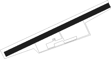
Runway info
| Runway 06 / 24 | ||
| length | 657m (2156ft) | |
| bearing | 76° / 256° | |
| width | 30m (98ft) | |
| surface | grass | |
Nearby beacons
| code | identifier | dist | bearing | frequency |
|---|---|---|---|---|
| FUL | FULDA VOR/DME | 8.2 | 119° | 112.10 |
| GED | GEDERN VORTAC | 17.4 | 211° | 110.80 |
| FTZ | FRITZLAR NDB | 24 | 1° | 468 |
| MTR | METRO VOR | 32.5 | 234° | 110 |
| DKS | DME-ILS | 44.3 | 360° | 111.50 |
| FR | FRANKFURT NDB | 46.3 | 230° | 297 |
| CHA | CHARLIE VOR/DME | 47.9 | 206° | 115.35 |
| FFM | FRANKFURT VORTAC | 48 | 231° | 114.20 |
| WRB | WARBURG VOR/DME | 50.6 | 340° | 113.70 |
| FRD | DME | 50.8 | 232° | 115.90 |
| FW | FRANKFURT NDB | 55.4 | 235° | 382 |
| VFM | NAUHEIM VOR | 56.3 | 232° | 113.75 |
| PAD | DME-ILS | 63.1 | 320° | 108.50 |
| PAD | PADERBORN-LIPPSTADT NDB | 63.5 | 321° | 354 |
| RID | RIED VOR/DME | 63.6 | 224° | 112.20 |
Disclaimer
The information on this website is not for real aviation. Use this data with the X-Plane flight simulator only! Data taken with kind consent from X-Plane 12 source code and data files. Content is subject to change without notice.