Miltenberg - Mainbullau
Airport details
| Country | Germany |
| State | Bavaria |
| Region | ED |
| Airspace | Langen Ctr |
| Municipality | Miltenberg |
| Elevation | 1500ft (457m) |
| Timezone | GMT +1 |
| Coordinates | 49.69500, 9.18200 |
| Magnetic var | |
| Type | land |
| Available since | X-Plane v10.40 |
| ICAO code | EDFU |
| IATA code | n/a |
| FAA code | n/a |
Communication
| Mainbullau Mainbullau Info | 121.035 |
Nearby Points of Interest:
Synagoge
-Burg Frankenberg
-Schloss Laudenbach (Unterfranken)
-Friedhof
-Rathaus
-Jagdschloß Eulbach
-Stadtschloss Klingenberg
-Turmhügel Heunenhügel
-Kuratiekirche
-St. Nikolaus
-Bergfried
-Bildstock
-Watterbacher Haus
-Friedhof Michelstadt
-Burg Lützelbach
-Rathaus Michelstadt
-Alte Brauerei
-Marktplatz 6
-Evangelische Kirche Bad König
-Schloss Bad König
-Dürrhofkapelle
-Habermannsburg
-Burgmannenhaus Pavey
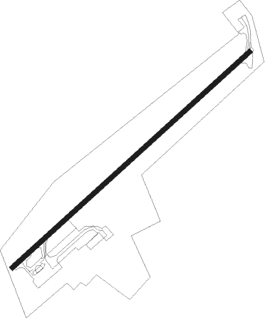
Runway info
| Runway 05 / 23 | ||
| length | 690m (2264ft) | |
| bearing | 63° / 243° | |
| width | 10m (33ft) | |
| surface | asphalt | |
| displ threshold | 20m (66ft) / 0m (0ft) | |
Nearby beacons
| code | identifier | dist | bearing | frequency |
|---|---|---|---|---|
| CHA | CHARLIE VOR/DME | 14.6 | 328° | 115.35 |
| RID | RIED VOR/DME | 25.4 | 278° | 112.20 |
| NKR | NECKAR NDB | 27.7 | 231° | 292 |
| MND | DME | 29.2 | 251° | 113.55 |
| FR | FRANKFURT NDB | 29.4 | 307° | 297 |
| FFM | FRANKFURT VORTAC | 30.1 | 303° | 114.20 |
| FRD | DME | 31.1 | 299° | 115.90 |
| VFM | NAUHEIM VOR | 31.8 | 291° | 113.75 |
| FW | FRANKFURT NDB | 34.5 | 292° | 382 |
| NDD | DME-ILS | 35.3 | 111° | 108.70 |
| NSN | NIEDERSTETTEN NDB | 35.4 | 111° | 311 |
| MTR | METRO VOR | 37.2 | 330° | 110 |
| WIB | WIESBADEN TACAN | 39.7 | 292° | 114.10 |
| SHD | HALL DME | 41.8 | 134° | 108.05 |
| GED | GEDERN VORTAC | 43.1 | 5° | 110.80 |
| LBU | LUBURG VOR/DME | 47.3 | 169° | 109.20 |
| KRH | KARLSRUHE VOR/DME | 48.2 | 220° | 115.95 |
| FUL | FULDA VOR/DME | 55.9 | 23° | 112.10 |
| STG | STUTTGART VOR/DME | 60 | 176° | 116.85 |
Disclaimer
The information on this website is not for real aviation. Use this data with the X-Plane flight simulator only! Data taken with kind consent from X-Plane 12 source code and data files. Content is subject to change without notice.