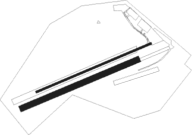
Breitscheid
Airport details
| Country | Germany |
| State | Hesse |
| Region | ED |
| Airspace | Langen Ctr |
| Municipality | Breitscheid |
| Elevation | 1833ft (559m) |
| Timezone | GMT +1 |
| Coordinates | 50.67946, 8.17045 |
| Magnetic var | |
| Type | land |
| Available since | X-Plane v10.40 |
| ICAO code | EDGB |
| IATA code | n/a |
| FAA code | n/a |
Communication
| Breitscheid Breitscheid Info | 122.600 |
Nearby Points of Interest:
Protestant Church
-Evangelische Kirche
-Evangelische Kapelle
-Ehemalige Evangelische Kirche
-Oberburg Driedorf
-Evangelische Kirche Driedorf
-Evangelische Kirche Herborn-Guntersdorf
-Katholische Kirche
-Evangelische Kirche Haiger-Allendorf
-Amtsgericht Herborn
-Kirchenruine Feldbach
-Burgstall Burg
-Evangelische Kirche Haiger-Rodenbach
-Pfarrkirche Nenderoth
-Villa Haas
-Burg Alt-Dernbach
-Evangelische Kirche (Edingen)
-Evangelische Kirche Fellerdilln
-Denkmal 1914/18
-Evangelische Kirche Haiger-Niederrossbach
-Evangelische Kirche Dillenburg-Frohnhausen
-Category:Evangelische Kirche (Greifenstein-Ulm)

Nearby beacons
| code | identifier | dist | bearing | frequency |
|---|---|---|---|---|
| SIL | SIEGERLAND NDB | 1.2 | 271° | 489 |
| SLD | DME | 3.8 | 287° | 108.05 |
| COL | COLA VOR/DME | 22.7 | 280° | 108.80 |
| TAU | TAUNUS VOR/DME | 25.7 | 181° | 113.35 |
| GMH | GERMINGHAUSEN VOR/DME | 31.3 | 330° | 115.40 |
| MTR | METRO VOR | 35.4 | 121° | 110 |
| LV | COLOGNE-BONN NDB | 36.1 | 278° | 327 |
| LW | COLOGNE-BONN NDB | 37.2 | 283° | 300 |
| WIB | WIESBADEN TACAN | 38.4 | 168° | 114.10 |
| WYP | WIPPER VOR | 40.3 | 293° | 109.60 |
| FFM | FRANKFURT VORTAC | 41.6 | 143° | 114.20 |
| FR | FRANKFURT NDB | 41.7 | 140° | 297 |
| FW | FRANKFURT NDB | 41.7 | 159° | 382 |
| FRD | DME | 41.8 | 149° | 115.90 |
| VFM | NAUHEIM VOR | 44.6 | 157° | 113.75 |
| BAM | BARMEN VOR/DME | 54 | 303° | 114 |
| DOR | WICKEDE (DORTMUND) VOR/DME | 54.7 | 327° | 108.65 |
| DWI | DORTMUND-WICKEDE NDB | 54.7 | 328° | 357 |
| HAN | HAHN NDB | 54.8 | 231° | 376 |
| RID | RIED VOR/DME | 55.7 | 158° | 112.20 |
| CHA | CHARLIE VOR/DME | 56.4 | 131° | 115.35 |
| FHH | DME | 56.4 | 231° | 117.35 |
| PAD | DME-ILS | 58.3 | 26° | 108.50 |
| PAD | PADERBORN-LIPPSTADT NDB | 59.3 | 26° | 354 |
| WRB | WARBURG VOR/DME | 60.9 | 49° | 113.70 |
Disclaimer
The information on this website is not for real aviation. Use this data with the X-Plane flight simulator only! Data taken with kind consent from X-Plane 12 source code and data files. Content is subject to change without notice.