Fulda - Fulda Jossa
Airport details
| Country | Germany |
| State | Hesse |
| Region | ED |
| Airspace | Langen Ctr |
| Municipality | Jossa |
| Elevation | 1558ft (475m) |
| Timezone | GMT +1 |
| Coordinates | 50.47556, 9.44194 |
| Magnetic var | |
| Type | land |
| Available since | X-Plane v10.40 |
| ICAO code | EDGF |
| IATA code | n/a |
| FAA code | n/a |
Communication
| Fulda Jossa Fulda Info | 122.400 |
Nearby Points of Interest:
Saint Mary Chapel (Jossa, Hosenfeld)
-Naxburg
-Evangelische Kirche Freiensteinau
-Edelhof
-Evangelische Kirche Altenschlirf
-Kloster Blankenau
-Synagoge Lichenroth
-Evangelische Kirche (Ilbeshausen)
-Kriegerdenkmal
-Jagdschloss Giesel
-Synagoge Flieden
-Eisenbacher Straße 1
-Saint Joseph Chapel
-Alter Jüdischer Friedhof
-Bismarck Tower
-Synagoge Schlüchtern
-Am Mühlbach 30
-Eisenbahnbrücke (Frischborn)
-Evangelische Kirche Frischborn
-Zur Landwehr 4
-Propstei Johannesberg
-Church of the Assumption
-St. Vitus
-Am Eichberg 41
-Evangelische Kirche Dirlammen
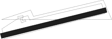
Runway info
| Runway 08 / 26 | ||
| length | 615m (2018ft) | |
| bearing | 84° / 264° | |
| width | 30m (98ft) | |
| surface | grass | |
Nearby beacons
| code | identifier | dist | bearing | frequency |
|---|---|---|---|---|
| GED | GEDERN VORTAC | 8.3 | 252° | 110.80 |
| FUL | FULDA VOR/DME | 8.6 | 48° | 112.10 |
| MTR | METRO VOR | 25.6 | 251° | 110 |
| FTZ | FRITZLAR NDB | 36.5 | 357° | 468 |
| CHA | CHARLIE VOR/DME | 36.7 | 216° | 115.35 |
| FR | FRANKFURT NDB | 38.1 | 242° | 297 |
| FFM | FRANKFURT VORTAC | 39.9 | 242° | 114.20 |
| FRD | DME | 42.9 | 243° | 115.90 |
| VFM | NAUHEIM VOR | 48.4 | 242° | 113.75 |
| RID | RIED VOR/DME | 54.2 | 232° | 112.20 |
| DKS | DME-ILS | 56.8 | 358° | 111.50 |
Disclaimer
The information on this website is not for real aviation. Use this data with the X-Plane flight simulator only! Data taken with kind consent from X-Plane 12 source code and data files. Content is subject to change without notice.