Hettstadt
Airport details
| Country | Germany |
| State | Bavaria |
| Region | ED |
| Airspace | Langen Ctr |
| Municipality | Hettstadt |
| Elevation | 1047ft (319m) |
| Timezone | GMT +1 |
| Coordinates | 49.79861, 9.83694 |
| Magnetic var | |
| Type | land |
| Available since | X-Plane v10.40 |
| ICAO code | EDGH |
| IATA code | n/a |
| FAA code | n/a |
Communication
| Hettstadt Hettstadt Info | 122.425 |
Nearby Points of Interest:
Künstlerhaus
-Rathaus
-Brücke
-Balthasar Neumann Haus
-Huttenschlösschen
-Krankenhaus
-Domherrenhof
-Spital
-Hofbeamtenwohnhaus
-Kapelle
-Mietshaus
-Kreuzweg
-Kloster Holzkirchen
-Schloß
-Synagoge
-14-Heiligen-Kapelle
-Mariengrotte
-Johanniterkastell
-Burgstall Erbshausen
-Pfarrkirche
-Skulpturengruppe
-Hauptstraße 9/11
-Hauptstraße 7
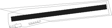
Runway info
| Runway 09 / 27 | ||
| length | 555m (1821ft) | |
| bearing | 88° / 268° | |
| width | 29m (95ft) | |
| surface | grass | |
Nearby beacons
| code | identifier | dist | bearing | frequency |
|---|---|---|---|---|
| NSN | NIEDERSTETTEN NDB | 24.7 | 162° | 311 |
| NDD | DME-ILS | 24.8 | 163° | 108.70 |
| ILM | ILLESHEIM NDB | 29 | 121° | 488 |
| CHA | CHARLIE VOR/DME | 31.7 | 279° | 115.35 |
| SHD | HALL DME | 41 | 185° | 108.05 |
| DKB | DINKELSBUEHL VORTAC | 42.3 | 149° | 117.80 |
| ANS | ANSBACH NDB | 42.7 | 122° | 452 |
| GED | GEDERN VORTAC | 43.2 | 316° | 110.80 |
| MTR | METRO VOR | 47.7 | 296° | 110 |
| FUL | FULDA VOR/DME | 48.7 | 342° | 112.10 |
| LBU | LUBURG VOR/DME | 56.6 | 209° | 109.20 |
Disclaimer
The information on this website is not for real aviation. Use this data with the X-Plane flight simulator only! Data taken with kind consent from X-Plane 12 source code and data files. Content is subject to change without notice.