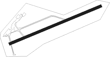
Lübeck - Luebeck Blankensee
Airport details
| Country | Germany |
| State | Schleswig-Holstein |
| Region | ED |
| Airspace | Bremen Ctr |
| Municipality | Lübeck |
| Elevation | 53ft (16m) |
| Timezone | GMT +1 |
| Coordinates | 53.80537, 10.71922 |
| Magnetic var | |
| Type | land |
| Available since | X-Plane v10.40 |
| ICAO code | EDHL |
| IATA code | LBC |
| FAA code | n/a |
Communication
| Luebeck Blankensee Luebeck ATIS | 119.925 |
| Luebeck Blankensee Luebeck ground | 121.775 |
| Luebeck Blankensee Luebeck tower | 128.700 |
| Luebeck Blankensee BREMEN RADAR | 124.225 |
| Luebeck Blankensee BREMEN INFO | 125.100 |
Approach frequencies
| ILS-cat-II | RW07 | 109.35 | 18.00mi |
| ILS-cat-I | RW25 | 111.7 | 18.00mi |
| 3° GS | RW07 | 109.35 | 18.00mi |
| 3° GS | RW25 | 111.7 | 18.00mi |
Nearby Points of Interest:
Zollhaus Herrnburg
-Klosterhofschule
-Moltkestraße
-Alter Zolln
-An der Mauer 154
-Zeughaus Lübeck
-St. Anne's Museum Quarter
-Aegidienhof
-Michaeliskonvent
-Kapitelstraße 7
-Schildstraße 10
-Aegidienstraße 22
-Aegidienstraße 24
-Tor der Hoffnung
-ehem. Kaufhaus am Klingenberg
-Fleischhauerstraße 67
-Königstrasse 81 (Lübeck)
-Holstentorhalle
-Kaak
-Lübeck city hall
-Salzspeicher
-Hermbergsches Haus
-Kiosk
-Rio
-Königstraße 43
Nearby beacons
| code | identifier | dist | bearing | frequency |
|---|---|---|---|---|
| LYE | LUEBECK NDB | 0.8 | 259° | 394 |
| HAM | HAMBURG VORTAC | 19.6 | 257° | 113.10 |
| ALF | DME | 27.7 | 257° | 115.80 |
| KHD | (HOLTENAU) DME-ILS | 39.9 | 315° | 109.50 |
| KIL | KIEL-HOLTENAU NDB | 40.3 | 314° | 353 |
| PAH | SCHWERIN-PARCHIM NDB | 41.8 | 113° | 315 |
| BKD | BRUENKENDORF VOR/DME | 54.9 | 133° | 117.70 |
| FSB | FASSBERG NDB | 56.7 | 211° | 284 |
Departure and arrival routes
| Transition altitude | 5000ft |
| SID end points | distance | outbound heading | |
|---|---|---|---|
| RW07 | |||
| HAM1A, HAM6J | 20mi | 257° | |
| RW25 | |||
| HAM1K, HAM6H | 20mi | 257° | |
| STAR starting points | distance | inbound heading | |
|---|---|---|---|
| RW07 | |||
| NOLG1V | 32.1 | 55° | |
| BOGM1V | 18.4 | 112° | |
| RW25 | |||
| NOLG1R | 32.1 | 55° | |
| BOGM1R | 18.4 | 112° | |
Instrument approach procedures
| runway | airway (heading) | route (dist, bearing) |
|---|---|---|
| RW07 | HL265 (79°) | HL265 3000ft HL266 (2mi, 79°) 3000ft |
| RW07 | LYE (79°) | LYE 3000ft HL225 (14mi, 272°) HL265 (5mi, 151°) HL266 (2mi, 79°) 3000ft |
| RNAV | HL266 3000ft BITNA (2mi, 79°) 3000ft EDHL (10mi, 79°) 103ft HL006 (3mi, 79°) LYE (4mi, 259°) 3000ft | |
| RW25 | HL165 (259°) | HL165 3500ft HL166 (2mi, 259°) 3000ft |
| RW25 | LYE (79°) | LYE 3000ft HL125 (15mi, 66°) HL165 (5mi, 152°) HL166 (2mi, 259°) 3000ft |
| RNAV | HL166 3000ft ROXEM (2mi, 259°) 3000ft EDHL (10mi, 259°) 98ft HL003 (3mi, 259°) LYE (3mi, 79°) 3000ft |
Holding patterns
| STAR name | hold at | type | turn | heading* | altitude | leg | speed limit |
|---|---|---|---|---|---|---|---|
| BOGM1R | BOGMU | VHF | right | 49 (229)° | 4000ft - 11000ft | 1.0min timed | 230 |
| BOGM1R | HL165 | VHF | right | 69 (249)° | 3500ft - 11000ft | 1.0min timed | 230 |
| BOGM1V | BOGMU | VHF | right | 49 (229)° | 4000ft - 11000ft | 1.0min timed | 230 |
| BOGM1V | HL265 | VHF | right | 249 (69)° | 3000ft - 11000ft | 1.0min timed | 230 |
| NOLG1R | HL165 | VHF | right | 69 (249)° | 3500ft - 11000ft | 1.0min timed | 230 |
| NOLG1R | NOLGO | VHF | left | 185 (5)° | 4000ft - 11000ft | 1.0min timed | 230 |
| NOLG1R | RARUP | VHF | right | 96 (276)° | 4000ft - 11000ft | 1.0min timed | 230 |
| NOLG1V | HL265 | VHF | right | 249 (69)° | 3000ft - 11000ft | 1.0min timed | 230 |
| NOLG1V | NOLGO | VHF | left | 185 (5)° | 4000ft - 11000ft | 1.0min timed | 230 |
| RARU1R | HL165 | VHF | right | 69 (249)° | 3500ft - 11000ft | 1.0min timed | 230 |
| RARU1R | RARUP | VHF | right | 96 (276)° | 4000ft - 11000ft | 1.0min timed | 230 |
| RARU1V | HL265 | VHF | right | 249 (69)° | 3000ft - 11000ft | 1.0min timed | 230 |
| RARU1V | RARUP | VHF | right | 96 (276)° | 4000ft - 11000ft | 1.0min timed | 230 |
| *) magnetic outbound (inbound) holding course | |||||||
Disclaimer
The information on this website is not for real aviation. Use this data with the X-Plane flight simulator only! Data taken with kind consent from X-Plane 12 source code and data files. Content is subject to change without notice.