Grabenstätt
Airport details
| Country | Germany |
| State | Bavaria |
| Region | ED |
| Airspace | Munich Ctr |
| Municipality | Grabenstätt |
| Elevation | 1762ft (537m) |
| Timezone | GMT +1 |
| Coordinates | 47.85300, 12.55050 |
| Magnetic var | |
| Type | land |
| Available since | X-Plane v10.40 |
| ICAO code | EDJG |
| IATA code | n/a |
| FAA code | n/a |
Communication
| Grabenstätt Grabenstätt Info | 129.975 |
Nearby Points of Interest:
Kapelle
-Schloss Neuenchieming
-Meilenstein von Erlstätt
-Äußere Rosenheimer Straße 21 (Traunstein)
-Tafernwirtschaft
-Pertenstein
-Bayerisches Moor- und Torfmuseum
-Achentalstraße 11
-Friedhof Ruhpolding
-Chiemsee-Bahn
-Findling Bitterstein WNW von Holzhausen
-Stein Castle
-Burgstall Raiten
-Toteisloch bei Klosterseeon
-Seeon Abbey
-Pfarrhof
-Burg Baumburg
-Baumburg Abbey
-Category:Bahnhofstraße 17 (Waging am See)
-Klosterkirche St. Margarethen
-Erholungsheim
-St. Laurentius
-Schloss Schedling
-Blasialm
-Harbachalm
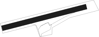
Runway info
| Runway 08 / 26 | ||
| length | 478m (1568ft) | |
| bearing | 83° / 263° | |
| width | 30m (98ft) | |
| surface | grass | |
| displ threshold | 35m (115ft) / 0m (0ft) | |
Nearby beacons
| code | identifier | dist | bearing | frequency |
|---|---|---|---|---|
| SBG | SALZBURG NDB | 15.4 | 72° | 382 |
| SBG | SALZBURG VOR/DME | 16.4 | 66° | 113.80 |
| SI | SALZBURG NDB | 17.7 | 94° | 410 |
| GSB | DME | 22.8 | 95° | 109.45 |
| RTT | RATTENBERG NDB | 35.3 | 235° | 303 |
| OTT | OTTERSBERG VOR/DME | 35.4 | 294° | 112.30 |
| MSW | MUNICH NDB | 39.6 | 308° | 400 |
| MNW | MUNICH NDB | 40.3 | 309° | 338 |
| DMS | DME | 42.6 | 302° | 115 |
| DMN | DME | 43.2 | 304° | 116 |
| MSE | MUNICH NDB | 46.1 | 298° | 358 |
| MNE | MUNICH NDB | 46.2 | 300° | 369 |
| MIQ | MIKE NDB | 57.5 | 307° | 426 |
| IGL | INGOLSTADT NDB | 64.2 | 314° | 345 |
| IGL | INGOLSTADT TACAN | 65 | 311° | 111.40 |
Disclaimer
The information on this website is not for real aviation. Use this data with the X-Plane flight simulator only! Data taken with kind consent from X-Plane 12 source code and data files. Content is subject to change without notice.