Altena - Altena - Hegenscheid
Airport details
| Country | Germany |
| State | North Rhine-Westphalia |
| Region | ED |
| Airspace | Langen Ctr |
| Municipality | Iserlohn |
| Elevation | 1549ft (472m) |
| Timezone | GMT +1 |
| Coordinates | 51.31300, 7.70367 |
| Magnetic var | |
| Type | land |
| Available since | X-Plane v10.32 |
| ICAO code | EDKD |
| IATA code | n/a |
| FAA code | n/a |
Communication
| Altena - Hegenscheid Altena Info | 121.190 |
Nearby Points of Interest:
Jewish cemetery, Altena
-Netter Dömchen
-Hof Dümpel
-Werkssiedlung Langenstück
-Schlieperblock
-Iserlohn City Library
-Wichelhovenhaus
-Villa Wessel
-Villa Ebbinghaus-Möllmann
-Villa Klute
-Jüdischer Friedhof (Iserlohn)
-Villa Heutelbeck
-Westig railway station
-Rathaus Werdohl
-Ostdeutsche Heimatstuben und Heimatmuseum Ohlau
-Fabrikantenhaus von der Becke
-Amtshaus Hemer
-Villa Prinz
-Beginenhof Deilinghofen
-Synagoge Hohenlimburg
-Platehof
-Schützenhalle (Lüdenscheid)
-Selve-Mausoleum
-Amtsgericht Lüdenscheid
-Villa Hueck
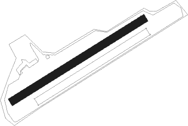
Runway info
| Runway 06 / 24 | ||
| length | 598m (1962ft) | |
| bearing | 72° / 252° | |
| width | 30m (98ft) | |
| surface | grass | |
Nearby beacons
| code | identifier | dist | bearing | frequency |
|---|---|---|---|---|
| GMH | GERMINGHAUSEN VOR/DME | 11.1 | 127° | 115.40 |
| DOR | WICKEDE (DORTMUND) VOR/DME | 13 | 341° | 108.65 |
| DWI | DORTMUND-WICKEDE NDB | 13 | 342° | 357 |
| BAM | BARMEN VOR/DME | 19.7 | 272° | 114 |
| WYP | WIPPER VOR | 22.5 | 238° | 109.60 |
| LW | COLOGNE-BONN NDB | 30.1 | 227° | 300 |
| BOT | BOTTROP NDB | 30.2 | 292° | 406 |
| LI | DUESSELDORF NDB | 30.5 | 272° | 417 |
| COL | COLA VOR/DME | 32 | 192° | 108.80 |
| HMM | HAMM VOR/DME | 32.6 | 0° | 115.65 |
| LJ | COLOGNE-BONN NDB | 33.4 | 239° | 365 |
| KBO | COLOGNE-BONN VOR/DME | 34.3 | 231° | 112.15 |
| LV | COLOGNE-BONN NDB | 35.2 | 222° | 327 |
| DUS | DUESSELDORF VOR/DME | 35.7 | 268° | 115.15 |
| PAD | DME-ILS | 38.6 | 72° | 108.50 |
| SLD | DME | 39 | 148° | 108.05 |
| PAD | PADERBORN-LIPPSTADT NDB | 39.6 | 72° | 354 |
| SIL | SIEGERLAND NDB | 41.4 | 146° | 489 |
| MOD | DME | 49.5 | 359° | 114.05 |
| MYN | MUENSTER/OSNABRUECK NDB | 50.9 | 6° | 371 |
| OSB | OSNABRUCK TACAN | 57.5 | 33° | 108.35 |
| OSN | OSNABRUECK VOR | 57.5 | 33° | 114.30 |
| RKN | DME | 60.4 | 311° | 116.80 |
Disclaimer
The information on this website is not for real aviation. Use this data with the X-Plane flight simulator only! Data taken with kind consent from X-Plane 12 source code and data files. Content is subject to change without notice.