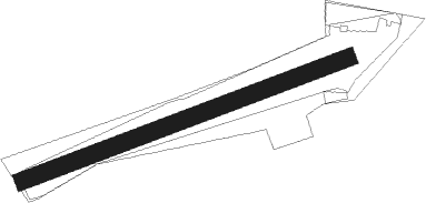
Betzdorf
Airport details
| Country | Germany |
| State | Rhineland-Palatinate |
| Region | ED |
| Airspace | Langen Ctr |
| Municipality | Katzwinkel (Sieg) |
| Elevation | 1125ft (343m) |
| Timezone | GMT +1 |
| Coordinates | 50.81816, 7.83250 |
| Magnetic var | |
| Type | land |
| Available since | X-Plane v10.40 |
| ICAO code | EDKI |
| IATA code | n/a |
| FAA code | n/a |
Communication
| Betzdorf Betzdorf Info | 122.230 |
Nearby Points of Interest:
Freusburger Mühle
-St. Aloisius (Herdorf)
-Protestant Church
-Motte Streithausen
-Grube Petersbach
-Reichsbank (Siegen)
-Jüdischer Friedhof Hermelsbach
-Abteikirche Marienstatt
-Jüdischer Friedhof Lindenberg
-Krupp-Hochhaus Geisweid
-St. Martinus
-Laurentiuskirche (Ferndorf)
-Sankt-Michaels-Kapelle Hoppengarten
-St. Josef
-Burg Reifershardt
-Amtsgericht Olpe
-Kloster Drolshagen
-St. Clemens
-Saint George Church
-Stadtbefestigung Olpe
-St.-Anna-Kirche (Belmicke)
-Jüdischer Friedhof
-Pallottihaus
-Evangelische Kirche Haiger-Allendorf
-Derschlag railway station
Nearby beacons
| code | identifier | dist | bearing | frequency |
|---|---|---|---|---|
| COL | COLA VOR/DME | 9.2 | 262° | 108.80 |
| SLD | DME | 11.4 | 114° | 108.05 |
| SIL | SIEGERLAND NDB | 14.2 | 114° | 489 |
| GMH | GERMINGHAUSEN VOR/DME | 21.2 | 10° | 115.40 |
| LV | COLOGNE-BONN NDB | 22.4 | 269° | 327 |
| LW | COLOGNE-BONN NDB | 22.4 | 278° | 300 |
| WYP | WIPPER VOR | 25 | 293° | 109.60 |
| KBO | COLOGNE-BONN VOR/DME | 26.1 | 274° | 112.15 |
| LJ | COLOGNE-BONN NDB | 29.9 | 278° | 365 |
| TAU | TAUNUS VOR/DME | 36.3 | 150° | 113.35 |
| BAM | BARMEN VOR/DME | 39.3 | 308° | 114 |
| DOR | WICKEDE (DORTMUND) VOR/DME | 43.1 | 344° | 108.65 |
| DWI | DORTMUND-WICKEDE NDB | 43.1 | 344° | 357 |
| LI | DUESSELDORF NDB | 47.6 | 299° | 417 |
| BUE | BUECHEL TACAN | 48.2 | 230° | 117.10 |
| WIB | WIESBADEN TACAN | 49.8 | 148° | 114.10 |
| FW | FRANKFURT NDB | 53.9 | 144° | 382 |
| FRD | DME | 55 | 137° | 115.90 |
| BOT | BOTTROP NDB | 55.2 | 313° | 406 |
| FFM | FRANKFURT VORTAC | 55.2 | 134° | 114.20 |
| HAN | HAHN NDB | 55.4 | 213° | 376 |
| FR | FRANKFURT NDB | 55.6 | 131° | 297 |
| PAD | DME-ILS | 56 | 45° | 108.50 |
| VFM | NAUHEIM VOR | 56.9 | 143° | 113.75 |
| FHH | DME | 57 | 213° | 117.35 |
| PAD | PADERBORN-LIPPSTADT NDB | 57 | 45° | 354 |
Disclaimer
The information on this website is not for real aviation. Use this data with the X-Plane flight simulator only! Data taken with kind consent from X-Plane 12 source code and data files. Content is subject to change without notice.