Meschede - Meschede-schueren
Airport details
| Country | Germany |
| State | North Rhine-Westphalia |
| Region | ED |
| Airspace | Langen Ctr |
| Municipality | Meschede |
| Elevation | 1436ft (438m) |
| Timezone | GMT +1 |
| Coordinates | 51.30233, 8.23733 |
| Magnetic var | |
| Type | land |
| Available since | X-Plane v10.32 |
| ICAO code | EDKM |
| IATA code | n/a |
| FAA code | n/a |
Communication
| Meschede-Schueren Meschede Info | 126.015 |
Nearby Points of Interest:
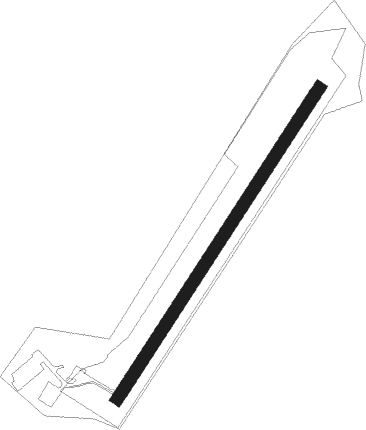
Meschede-Schüren Airport
-St. Jakobus d. Ä.
-St. Elisabeth
-Kapelle zu den 14 Nothelfern (Remblinghausen)
-Gut Stockhausen (Meschede)
-Gutskapelle St. Antonius
-Haus Niederberge
-Dominikanerinnenkloster Galiläa, Meschede
-St. Margaretha
-Rauchgaskamin (Ramsbeck)
-Hl. Drei Könige (Oberlandenbeck)
-Alte Mühle Cobbenrode
-St. Antonius Eremit (Dormecke)
-Heilig-Kreuz-Kapelle (Bad Fredeburg)
-Amtsgericht Schmallenberg
-Pfarrhaus Wormbach
-Amtsgericht Arnsberg
-Landgericht Arnsberg
-Husemann House
-Zivilkasino Arnsberg
-Marienhospital Arnsberg
-Stockhausenhaus
-Groten-Turm
-Altes Rathaus Arnsberg
-Haus Zur Krim
Nearby beacons
| code | identifier | dist | bearing | frequency |
|---|---|---|---|---|
| GMH | GERMINGHAUSEN VOR/DME | 15.2 | 249° | 115.40 |
| PAD | DME-ILS | 23.3 | 51° | 108.50 |
| PAD | PADERBORN-LIPPSTADT NDB | 24.4 | 51° | 354 |
| DWI | DORTMUND-WICKEDE NDB | 26.2 | 290° | 357 |
| DOR | WICKEDE (DORTMUND) VOR/DME | 26.3 | 290° | 108.65 |
| WRB | WARBURG VOR/DME | 34.9 | 77° | 113.70 |
| SLD | DME | 36.2 | 195° | 108.05 |
| SIL | SIEGERLAND NDB | 37.5 | 189° | 489 |
| HMM | HAMM VOR/DME | 38.7 | 316° | 115.65 |
| WYP | WIPPER VOR | 39.1 | 255° | 109.60 |
| COL | COLA VOR/DME | 39.5 | 231° | 108.80 |
| LW | COLOGNE-BONN NDB | 44.3 | 248° | 300 |
| LV | COLOGNE-BONN NDB | 48 | 243° | 327 |
| MYN | MUENSTER/OSNABRUECK NDB | 53.9 | 333° | 371 |
| OSB | OSNABRUCK TACAN | 53.9 | 3° | 108.35 |
| OSN | OSNABRUECK VOR | 53.9 | 3° | 114.30 |
| MOD | DME | 54.1 | 327° | 114.05 |
| BYC | BUECKEBURG NDB | 67.3 | 41° | 368 |
Disclaimer
The information on this website is not for real aviation. Use this data with the X-Plane flight simulator only! Data taken with kind consent from X-Plane 12 source code and data files. Content is subject to change without notice.