Goch - Goch-asperden
Airport details
| Country | Germany |
| State | North Rhine-Westphalia |
| Region | ED |
| Airspace | Langen Ctr |
| Municipality | Goch |
| Elevation | 51ft (16m) |
| Timezone | GMT +1 |
| Coordinates | 51.69083, 6.10417 |
| Magnetic var | |
| Type | land |
| Available since | X-Plane v10.40 |
| ICAO code | EDLG |
| IATA code | n/a |
| FAA code | n/a |
Communication
| Goch-Asperden Goch Info | 118.455 |
Nearby Points of Interest:
Saint Peter Church
-Paterskapel
-Maria Roepaan
-Onze-Lieve-Vrouw-van-Smartenkapel
-Mariakapel
-Museum Het Petershuis
-Protestantse Kerk
-Sint-Antonius Abtkapel
-Hertefeld Castle
-Kasteel Boxmeer
-R.K. Kapel van St. Jan Nepomuk
-Nederlands Hervormde Kerk, Boxmeer
-Oude Toren
-Karmelietenklooster
-Museum Kurhaus Kleve
-Joodse begraafplaats van Vierlingsbeek
-Haus Schmithausen
-Huis Middelaar
-St. Martin
-Onze-Lieve-Vrouw-Onbevlekt-Ontvangenkapel
-Sint-Rochuskapel
-Johanneskapelle
-Kasteel Well
-Nederlands Hervormde kerk
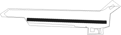
Runway info
| Runway 10 / 28 | ||
| length | 796m (2612ft) | |
| bearing | 94° / 274° | |
| width | 30m (98ft) | |
| surface | grass | |
Nearby beacons
| code | identifier | dist | bearing | frequency |
|---|---|---|---|---|
| NID | DME | 5.6 | 158° | 115.50 |
| LAA | NIEDERRHEIN NDB | 5.9 | 142° | 352 |
| VKL | VOLKEL TACAN | 14.9 | 265° | 108.30 |
| LMA | LIMA NDB | 22 | 138° | 311 |
| DLN | DEELEN TACAN | 23.6 | 328° | 112.20 |
| EHV | EINDHOVEN TACAN | 30.8 | 252° | 117.20 |
| MHV | MOENCHENGLADBACH VOR | 30.8 | 140° | 109.80 |
| MHD | DME | 30.9 | 140° | 112.50 |
| DY | DUESSELDORF NDB | 34.2 | 130° | 284 |
| DUS | DUESSELDORF VOR/DME | 34.4 | 122° | 115.15 |
| BOT | BOTTROP NDB | 34.8 | 97° | 406 |
| LI | DUESSELDORF NDB | 35.9 | 114° | 417 |
| RKN | DME | 36 | 56° | 116.80 |
| BBL | KLEINE BROGEL TACAN | 39.5 | 231° | 109.60 |
| NW | MAASTRICHT NDB | 41.2 | 199° | 373 |
| MAS | MAASTRICHT VOR/DME | 43.5 | 191° | 108.60 |
| GIX | GEILENKIRCHEN TACAN | 43.7 | 185° | 108.10 |
| FRO | DME | 50.7 | 322° | 111.40 |
| WNN | DME | 55.5 | 147° | 109.85 |
| NVO | NOERVENICH VORTAC | 55.8 | 148° | 116.20 |
| LJ | COLOGNE-BONN NDB | 58.2 | 129° | 365 |
| FLO | FLORA VOR/DME | 60.9 | 230° | 112.05 |
| ONL | LIEGE NDB | 63 | 209° | 290 |
Disclaimer
The information on this website is not for real aviation. Use this data with the X-Plane flight simulator only! Data taken with kind consent from X-Plane 12 source code and data files. Content is subject to change without notice.