Hamm - Hamm Lippewiesen
Airport details
| Country | Germany |
| State | North Rhine-Westphalia |
| Region | ED |
| Airspace | Langen Ctr |
| Municipality | Hamm |
| Elevation | 189ft (58m) |
| Timezone | GMT +1 |
| Coordinates | 51.68933, 7.81356 |
| Magnetic var | |
| Type | land |
| Available since | X-Plane v10.40 |
| ICAO code | EDLH |
| IATA code | n/a |
| FAA code | n/a |
Communication
| HAMM Lippewiesen HAMM INFO | 134.055 |
Nearby Points of Interest:
Stuniken-Haus
-Amtsgericht Hamm
-Rathaus Hamm
-Alfred-Fischer-Halle
-Burg Mark
-Lippeschleuse Heessen
-Jüdischer Friedhof
-Bahnhof Lenningsen
-Herz-Jesu-Kirche (Heeren-Werve)
-Gutshof Schulze Heil
-Haus Koeningen
-Werl Prison
-Maria Magdalena
-Amtsgericht Werl
-Johanneskirche
-St. Joseph
-St. Stephanus
-St. Antonius (Stocklarn)
-Amtsgericht Unna
-Ziegelei Siegeroth
-Kantine Westfalia
-Zur schmerzhaften Mutter
-Amtsgericht Lünen
-Wasserwerk Hohe Ward
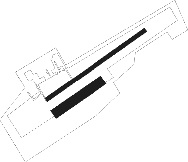
Runway info
Runway 06 / 24  | ||
| length | 614m (2014ft) | |
| bearing | 70° / 250° | |
| width | 20m (66ft) | |
| surface | asphalt | |
| Runway 05 / 23 | ||
| length | 268m (879ft) | |
| bearing | 70° / 250° | |
| width | 50m (164ft) | |
| surface | grass | |
Nearby beacons
| code | identifier | dist | bearing | frequency |
|---|---|---|---|---|
| HMM | HAMM VOR/DME | 10.7 | 328° | 115.65 |
| DWI | DORTMUND-WICKEDE NDB | 11.8 | 228° | 357 |
| DOR | WICKEDE (DORTMUND) VOR/DME | 11.9 | 228° | 108.65 |
| MOD | DME | 27.3 | 344° | 114.05 |
| MYN | MUENSTER/OSNABRUECK NDB | 28.2 | 358° | 371 |
| BOT | BOTTROP NDB | 30.1 | 263° | 406 |
| PAD | DME-ILS | 30.3 | 96° | 108.50 |
| PAD | PADERBORN-LIPPSTADT NDB | 31 | 95° | 354 |
| GMH | GERMINGHAUSEN VOR/DME | 31.2 | 171° | 115.40 |
| BAM | BARMEN VOR/DME | 32.2 | 240° | 114 |
| OSB | OSNABRUCK TACAN | 35.3 | 43° | 108.35 |
| OSN | OSNABRUECK VOR | 35.3 | 43° | 114.30 |
| LI | DUESSELDORF NDB | 40.1 | 250° | 417 |
| WYP | WIPPER VOR | 43.3 | 220° | 109.60 |
| LW | COLOGNE-BONN NDB | 51.9 | 215° | 300 |
| LJ | COLOGNE-BONN NDB | 53.7 | 225° | 365 |
| COL | COLA VOR/DME | 55 | 194° | 108.80 |
| KBO | COLOGNE-BONN VOR/DME | 55.6 | 219° | 112.15 |
| LV | COLOGNE-BONN NDB | 57.3 | 213° | 327 |
| DP | DIEPHOLZ NDB | 59.1 | 35° | 325 |
| SLD | DME | 59.8 | 165° | 108.05 |
Disclaimer
The information on this website is not for real aviation. Use this data with the X-Plane flight simulator only! Data taken with kind consent from X-Plane 12 source code and data files. Content is subject to change without notice.