Münster - Muenster - Telgte
Airport details
| Country | Germany |
| State | North Rhine-Westphalia |
| Region | ED |
| Airspace | Langen Ctr |
| Municipality | Telgte |
| Elevation | 176ft (54m) |
| Timezone | GMT +1 |
| Coordinates | 51.94467, 7.77267 |
| Magnetic var | |
| Type | land |
| Available since | X-Plane v10.40 |
| ICAO code | EDLT |
| IATA code | n/a |
| FAA code | n/a |
Communication
| Muenster - Telgte Telgte Info | 122.855 |
| Muenster - Telgte Bremen Radar | 133.000 |
Nearby Points of Interest:
Wallfahrtskapelle Telgte
-St. Clemens Telgte
-Gereonkapelle
-Gasometers in Münster
-Villa Sunder-Plaßmann
-Flechtheimspeicher
-Wasserwerk Hohe Ward
-Landeshaus Münster
-North Rhine-Westphalia State Archives Westphalia Division
-Lotharinger Chorfrauenkirche
-Raphaelsklinik Münster
-Deutsches Studentenheim
-Astronomische Uhr, Paulusdom, Münster
-Rothenburg 12/13
-Geologisch-Paläontologisches Museum Münster
-Amtsgericht Münster
-Rochuskapelle (Ostbevern)
-Haus Bevern
-Torhäuser am Neutor
-Speicherstadt Münster
-Brinkjans Krüüs
-Donatusstatue
-Kapelle zur schmerzhaften Mutter
-Heimathaus
-St. Maria Heil der Kranken
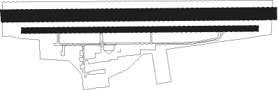
Runway info
Runway 10L / 28R  | ||
| length | 976m (3202ft) | |
| bearing | 92° / 272° | |
| width | 45m (148ft) | |
| surface | grass | |
| Runway 10 / 28 | ||
| length | 850m (2789ft) | |
| bearing | 92° / 272° | |
| width | 20m (66ft) | |
| surface | asphalt | |
| displ threshold | 119m (390ft) / 111m (364ft) | |
Nearby beacons
| code | identifier | dist | bearing | frequency |
|---|---|---|---|---|
| HMM | HAMM VOR/DME | 5.7 | 216° | 115.65 |
| MOD | DME | 12 | 336° | 114.05 |
| MYN | MUENSTER/OSNABRUECK NDB | 12.9 | 7° | 371 |
| OSB | OSNABRUCK TACAN | 24.3 | 64° | 108.35 |
| OSN | OSNABRUECK VOR | 24.3 | 64° | 114.30 |
| DWI | DORTMUND-WICKEDE NDB | 25.6 | 198° | 357 |
| DOR | WICKEDE (DORTMUND) VOR/DME | 25.7 | 199° | 108.65 |
| BOT | BOTTROP NDB | 35.2 | 244° | 406 |
| PAD | DME-ILS | 37.3 | 112° | 108.50 |
| PAD | PADERBORN-LIPPSTADT NDB | 37.5 | 110° | 354 |
| BAM | BARMEN VOR/DME | 43.1 | 224° | 114 |
| DP | DIEPHOLZ NDB | 46.2 | 46° | 325 |
| GMH | GERMINGHAUSEN VOR/DME | 46.7 | 171° | 115.40 |
| LI | DUESSELDORF NDB | 48.6 | 236° | 417 |
| WYP | WIPPER VOR | 56.8 | 209° | 109.60 |
Disclaimer
The information on this website is not for real aviation. Use this data with the X-Plane flight simulator only! Data taken with kind consent from X-Plane 12 source code and data files. Content is subject to change without notice.