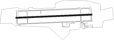
Weeze - Weeze - Niederrhein
Airport details
| Country | Germany |
| State | North Rhine-Westphalia |
| Region | ED |
| Airspace | Langen Ctr |
| Municipality | Weeze |
| Elevation | 104ft (32m) |
| Timezone | GMT +1 |
| Coordinates | 51.60241, 6.14217 |
| Magnetic var | |
| Type | land |
| Available since | X-Plane v10.40 |
| ICAO code | EDLV |
| IATA code | NRN |
| FAA code | n/a |
Communication
| Weeze - Niederrhein Niederrhein ATIS | 124.455 |
| Weeze - Niederrhein Niederrhein Tower | 129.405 |
| Weeze - Niederrhein Langen Radar | 119.110 |
Approach frequencies
| ILS-cat-III | RW27 | 110.7 | 18.00mi |
| 3° GS | RW27 | 110.7 | 18.00mi |
Nearby Points of Interest:
Hertefeld Castle
-Huis Roffaert
-Maria Chapel
-Kasteel Well
-Kerkhofkapel Calvarieberg
-Sint-Antonius Abtkapel
-Sint-Rochuskapel
-Johanneskapelle
-Oude Toren
-Paterskapel
-Protestantse kerk
-Onze-Lieve-Vrouw Geboortekerk
-Sint-Annakapel
-Sint-Willibrorduskapel
-Onze-Lieve-Vrouw-van-Smartenkapel
-Mariakapel
-Joodse begraafplaats van Vierlingsbeek
-Castle of Meerlo
-Saint Anne Chapel
-Spraland Castle
-Saint Peter Church
-Onze-Lieve-Vrouw-Sterre-der-Zeekapel
-Oostrumse watermolen
Nearby beacons
| code | identifier | dist | bearing | frequency |
|---|---|---|---|---|
| NID | DME | 0.1 | 196° | 115.50 |
| LAA | NIEDERRHEIN NDB | 1.1 | 91° | 352 |
| VKL | VOLKEL TACAN | 16.5 | 277° | 108.30 |
| LMA | LIMA NDB | 16.8 | 132° | 311 |
| MHV | MOENCHENGLADBACH VOR | 25.5 | 136° | 109.80 |
| MHD | DME | 25.6 | 136° | 112.50 |
| DLN | DEELEN TACAN | 29 | 329° | 112.20 |
| DY | DUESSELDORF NDB | 29.2 | 126° | 284 |
| DUS | DUESSELDORF VOR/DME | 29.8 | 118° | 115.15 |
| EHV | EINDHOVEN TACAN | 30.1 | 259° | 117.20 |
| LI | DUESSELDORF NDB | 31.9 | 109° | 417 |
| BOT | BOTTROP NDB | 32.8 | 91° | 406 |
| NW | MAASTRICHT NDB | 36.3 | 204° | 373 |
| BBL | KLEINE BROGEL TACAN | 36.4 | 237° | 109.60 |
| MAS | MAASTRICHT VOR/DME | 38.4 | 196° | 108.60 |
| GIX | GEILENKIRCHEN TACAN | 38.5 | 189° | 108.10 |
| RKN | DME | 39.3 | 50° | 116.80 |
| WNN | DME | 50.1 | 145° | 109.85 |
| NVO | NOERVENICH VORTAC | 50.3 | 148° | 116.20 |
| LJ | COLOGNE-BONN NDB | 53.2 | 126° | 365 |
| FRO | DME | 56.1 | 323° | 111.40 |
| ONL | LIEGE NDB | 58.5 | 213° | 290 |
| LGE | LIEGE VOR/DME | 62.3 | 215° | 115.45 |
Departure and arrival routes
| Transition altitude | 5000ft |
| SID end points | distance | outbound heading | |
|---|---|---|---|
| RW09 | |||
| SONE2R | 34mi | 56° | |
| ERKU1R | 21mi | 88° | |
| VEBA2R | 12mi | 125° | |
| RW27 | |||
| SONE3S | 34mi | 56° | |
| ERKU1S | 21mi | 88° | |
| VEBA4S | 12mi | 125° | |
| STAR starting points | distance | inbound heading | |
|---|---|---|---|
| ALL | |||
| SOBT1W | 16.1 | 257° | |
| LMA1W | 16.8 | 312° | |
Instrument approach procedures
| runway | airway (heading) | route (dist, bearing) |
|---|---|---|
| RW09 | LAA (271°) | LAA LV301 (10mi, 290°) 3000ft LV302 (4mi, 271°) LV303 (5mi, 183°) |
| RW09 | LMA (312°) | LMA LV700 (15mi, 296°) 3000ft LV701 (10mi, 271°) LV303 (5mi, 3°) |
| RW09 | SOBTU (257°) | SOBTU LV300 (17mi, 269°) 3500ft LV301 (6mi, 271°) 3000ft LV302 (4mi, 271°) LV303 (5mi, 183°) |
| RNAV | LV303 LERPA (4mi, 91°) 2500ft EDLV (8mi, 91°) 145ft LV310 (5mi, 91°) LAA (4mi, 271°) 3000ft |
Holding patterns
| STAR name | hold at | type | turn | heading* | altitude | leg | speed limit |
|---|---|---|---|---|---|---|---|
| LMA1W | LAA | FIX | right | 92 (272)° | > 3000ft | 1.0min timed | ICAO rules |
| SOBT1W | LAA | FIX | right | 92 (272)° | > 3000ft | 1.0min timed | ICAO rules |
| *) magnetic outbound (inbound) holding course | |||||||
Disclaimer
The information on this website is not for real aviation. Use this data with the X-Plane flight simulator only! Data taken with kind consent from X-Plane 12 source code and data files. Content is subject to change without notice.