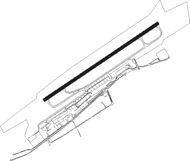
Dortmund - Dortmund - Wickede
Airport details
| Country | Germany |
| State | North Rhine-Westphalia |
| Region | ED |
| Airspace | Langen Ctr |
| Municipality | Dortmund |
| Elevation | 422ft (129m) |
| Timezone | GMT +1 |
| Coordinates | 51.51831, 7.61224 |
| Magnetic var | |
| Type | land |
| Available since | X-Plane v10.32 |
| ICAO code | EDLW |
| IATA code | DTM |
| FAA code | n/a |
Communication
| Dortmund - Wickede Dortmund ATIS | 125.130 |
| Dortmund - Wickede Dortmund ground | 121.830 |
| Dortmund - Wickede Dortmund tower | 134.180 |
| Dortmund - Wickede Langen Radar | 125.225 |
Approach frequencies
| ILS-cat-II | RW06 | 109.15 | 18.00mi |
| ILS-cat-II | RW24 | 111.3 | 18.00mi |
| 3° GS | RW06 | 109.15 | 18.00mi |
| 3° GS | RW24 | 111.3 | 18.00mi |
Nearby Points of Interest:
Bergbaubeamtensiedlung Neu-Asseln
-Amtshaus Aplerbeck
-Amtsgericht Unna
-Haus Altendorf
-Schwerter Wald
-Kreinberg
-Historische Kornbrennerei Bimberg
-Betriebswerk Dortmund Betriebsbahnhof
-Haus Villigst
-Schloss Dahlhausen
-Jüdischer Friedhof (Schwerte)
-Amtsgericht Dortmund
-Kraftwerk Dortmund
-regional court of Dortmund
-Amtsgericht Schwerte
-Gasometer Phoenix-West
-Herz-Jesu-Kirche (Heeren-Werve)
-Adler Apotheke
-Löwenhof (Dortmund)
-Hansakontor
-Gesundheitsamt Dortmund
-Kampstraße 45–47
-Ruhrflutbrücke Ergste
-Eisenbahnbrücke Wandhofen
-Westfalenhallen
Nearby beacons
| code | identifier | dist | bearing | frequency |
|---|---|---|---|---|
| DOR | WICKEDE (DORTMUND) VOR/DME | 0.8 | 70° | 108.65 |
| DWI | DORTMUND-WICKEDE NDB | 0.9 | 71° | 357 |
| BAM | BARMEN VOR/DME | 19.9 | 246° | 114 |
| HMM | HAMM VOR/DME | 20.6 | 16° | 115.65 |
| BOT | BOTTROP NDB | 22.3 | 277° | 406 |
| GMH | GERMINGHAUSEN VOR/DME | 23.3 | 141° | 115.40 |
| LI | DUESSELDORF NDB | 28.8 | 257° | 417 |
| WYP | WIPPER VOR | 30.8 | 215° | 109.60 |
| DUS | DUESSELDORF VOR/DME | 35.1 | 255° | 115.15 |
| MOD | DME | 37.3 | 7° | 114.05 |
| MYN | MUENSTER/OSNABRUECK NDB | 39.1 | 16° | 371 |
| LW | COLOGNE-BONN NDB | 39.6 | 210° | 300 |
| DY | DUESSELDORF NDB | 39.7 | 253° | 284 |
| LJ | COLOGNE-BONN NDB | 41 | 223° | 365 |
| KBO | COLOGNE-BONN VOR/DME | 43.1 | 215° | 112.15 |
| COL | COLA VOR/DME | 44.1 | 181° | 108.80 |
| LV | COLOGNE-BONN NDB | 45.1 | 208° | 327 |
| OSB | OSNABRUCK TACAN | 47.9 | 45° | 108.35 |
| OSN | OSNABRUECK VOR | 47.9 | 45° | 114.30 |
| RKN | DME | 48.5 | 306° | 116.80 |
| SLD | DME | 51.8 | 150° | 108.05 |
| SIL | SIEGERLAND NDB | 54.1 | 148° | 489 |
| WNN | DME | 54.2 | 234° | 109.85 |
| NVO | NOERVENICH VORTAC | 55.6 | 235° | 116.20 |
Departure and arrival routes
| Transition altitude | 5000ft |
| SID end points | distance | outbound heading | |
|---|---|---|---|
| RW06 | |||
| OSN8Q | 48mi | 45° | |
| NUDG3Q | 32mi | 97° | |
| BAMS2Q | 23mi | 223° | |
| DOME3Q | 12mi | 353° | |
| RW24 | |||
| OSN2U | 48mi | 45° | |
| NUDG2U | 32mi | 97° | |
| BAMS2U | 23mi | 223° | |
| DOME2U | 12mi | 353° | |
| STAR starting points | distance | inbound heading | |
|---|---|---|---|
| ALL | |||
| DOME2A | 11.5 | 173° | |
| ADEM2A | 10.5 | 277° | |
Instrument approach procedures
| runway | airway (heading) | route (dist, bearing) |
|---|---|---|
| RW06 | DOR (250°) | DOR LW007 (8mi, 215°) 3000ft LW008 (5mi, 250°) 3000ft LW009 (5mi, 318°) 2500ft |
| RNAV | LW009 2500ft KOLOT (4mi, 70°) 2500ft EDLW (7mi, 71°) 468ft LW012 (4mi, 71°) DOR (3mi, 251°) 3000ft | |
| RW24 | DOR (250°) | DOR LW010 (13mi, 86°) 3000ft LW011 (5mi, 318°) 3000ft |
| RNAV | LW011 3000ft ELVUL (4mi, 251°) 3000ft EDLW (8mi, 251°) 451ft LW005 (5mi, 251°) DOR (6mi, 70°) 3000ft |
Holding patterns
| STAR name | hold at | type | turn | heading* | altitude | leg | speed limit |
|---|---|---|---|---|---|---|---|
| ADEM2A | ADEMI | VHF | left | 104 (284)° | 6000ft - 14000ft | 1.0min timed | ICAO rules |
| ADEM2A | DOR | NDB | right | 239 (59)° | > 3000ft | 1.0min timed | ICAO rules |
| DOME2A | DOMEG | VHF | left | 350 (170)° | > 5000ft | 1.0min timed | ICAO rules |
| DOME2A | DOR | NDB | right | 239 (59)° | > 3000ft | 1.0min timed | ICAO rules |
| *) magnetic outbound (inbound) holding course | |||||||
Disclaimer
The information on this website is not for real aviation. Use this data with the X-Plane flight simulator only! Data taken with kind consent from X-Plane 12 source code and data files. Content is subject to change without notice.