Wesel - Wesel-roemerwardt
Airport details
| Country | Germany |
| State | North Rhine-Westphalia |
| Region | ED |
| Airspace | Langen Ctr |
| Municipality | Wesel |
| Elevation | 71ft (22m) |
| Timezone | GMT +1 |
| Coordinates | 51.66283, 6.59567 |
| Magnetic var | |
| Type | land |
| Available since | X-Plane v10.40 |
| ICAO code | EDLX |
| IATA code | n/a |
| FAA code | n/a |
Communication
| Wesel-Roemerwardt Wesel Info | 122.030 |
Nearby Points of Interest:
Poplar near Büderich
-Jüdischer Friedhof
-Salzbergwerk Borth
-Colonia Ulpia Traiana
-Bahnhof Möllen (Niederrhein)
-Humberghaus
-Altes Rathaus (Rheinberg)
-Schloss Sonsfeld
-Schloss Gartrop
-Jüdischer Friedhof Sonsbeck
-Bahnhof Walsum
-Rees Public Library
-Synagoge Issum
-Haus Issum
-St. Georg (Schermbeck)
-Siedlung Repelen
-Pumpwerk Schwelgern
-Synagoge Holten
-St. Gudula
-Pumpwerk Schmidthorst
-Bahnhof Duisburg-Hamborn
-Stadtbad Hamborn
-Haus Tervoort
-Pumpwerk Alte Emscher
-Amtsgericht Duisburg-Hamborn
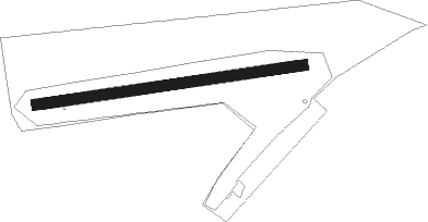
Runway info
| Runway 08 / 26 | ||
| length | 721m (2365ft) | |
| bearing | 88° / 268° | |
| width | 30m (98ft) | |
| surface | grass | |
Nearby beacons
| code | identifier | dist | bearing | frequency |
|---|---|---|---|---|
| LAA | NIEDERRHEIN NDB | 16.1 | 262° | 352 |
| BOT | BOTTROP NDB | 16.5 | 100° | 406 |
| NID | DME | 17.3 | 262° | 115.50 |
| LMA | LIMA NDB | 19 | 215° | 311 |
| LI | DUESSELDORF NDB | 21.9 | 137° | 417 |
| DUS | DUESSELDORF VOR/DME | 23.5 | 157° | 115.15 |
| DY | DUESSELDORF NDB | 25.8 | 172° | 284 |
| MHV | MOENCHENGLADBACH VOR | 25.8 | 194° | 109.80 |
| MHD | DME | 25.9 | 194° | 112.50 |
| RKN | DME | 28.9 | 20° | 116.80 |
| BAM | BARMEN VOR/DME | 29.6 | 120° | 114 |
| VKL | VOLKEL TACAN | 33.1 | 270° | 108.30 |
| DLN | DEELEN TACAN | 35.7 | 299° | 112.20 |
| WYP | WIPPER VOR | 44.9 | 132° | 109.60 |
| GIX | GEILENKIRCHEN TACAN | 46.8 | 218° | 108.10 |
| NW | MAASTRICHT NDB | 47 | 228° | 373 |
| LJ | COLOGNE-BONN NDB | 47.5 | 148° | 365 |
| MAS | MAASTRICHT VOR/DME | 47.8 | 223° | 108.60 |
| WNN | DME | 49.7 | 175° | 109.85 |
| NVO | NOERVENICH VORTAC | 50.4 | 177° | 116.20 |
| LW | COLOGNE-BONN NDB | 52.1 | 139° | 300 |
| KBO | COLOGNE-BONN VOR/DME | 52.3 | 146° | 112.15 |
| LV | COLOGNE-BONN NDB | 56.9 | 143° | 327 |
| COL | COLA VOR/DME | 64.8 | 131° | 108.80 |
Disclaimer
The information on this website is not for real aviation. Use this data with the X-Plane flight simulator only! Data taken with kind consent from X-Plane 12 source code and data files. Content is subject to change without notice.